Letts Popular Maps
The Atlas was first published in 1837 (Essex is dated 1835), and then several times to 1870 (or later), as Hobson's Fox Hunting Atlas (1850 to 1880), as Walker's fox hunting atlas and as Lett's Popular Atlas (1884 & 87). The maps were also published separately, dissected on cloth and folded up between boards.
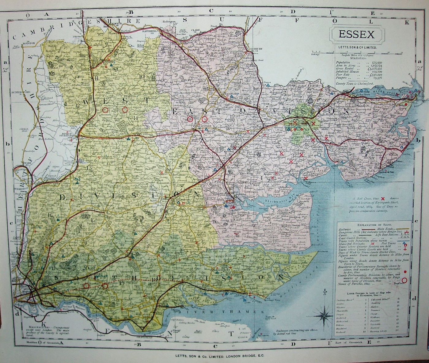
This is a lithographic copy from the J&C Walker map, with many additions. There are many symbols explained in a key, plus crosses to show the locations of an "earthquake shock" in April 1884.
Hundreds referenced to a table, plus symbols for polling places and other items. Hundreds neither colour washed nor edge-coloured, but Colchester, Harwich & Maldon Boroughs all shown as different colours from their Divisions. The three Divisions (1868 to 1885) are coloured, but only edged by a dashed line. Major roads have a thicker line on one side, and are coloured yellow; all other roads uncoloured.
The line to Clacton (authorisd 1877; opened 1882) has a red line, and there are projected railway lines shown by red dashes (not listed in the Explanation) from Barking to Pitsea (opened progressively 1885-88, but all authorised 1882), and from Southend to Shoeburyness (1882; 1884). However, the line from Shenfield to Wickford (1883; 1888) is not shown at all. The red line has been added to the Loughton "siding". The faint pecked black line from Romford to Thames Haven Docks has at long last gone.
The "By J&C Walker" under the cartouche has been replaced by "Letts, Son & Co Ltd". Below the base of the map is "Letts, Son & Co Limited, London Bridge, EC. I've assumed a sale date of 1884.
Scale correct at 12 miles = 77.5mm, or 3.9 miles/inch, ie 1:245,000 (ie a little larger than the original engraved map).