Philips' Atlas of the Counties of England
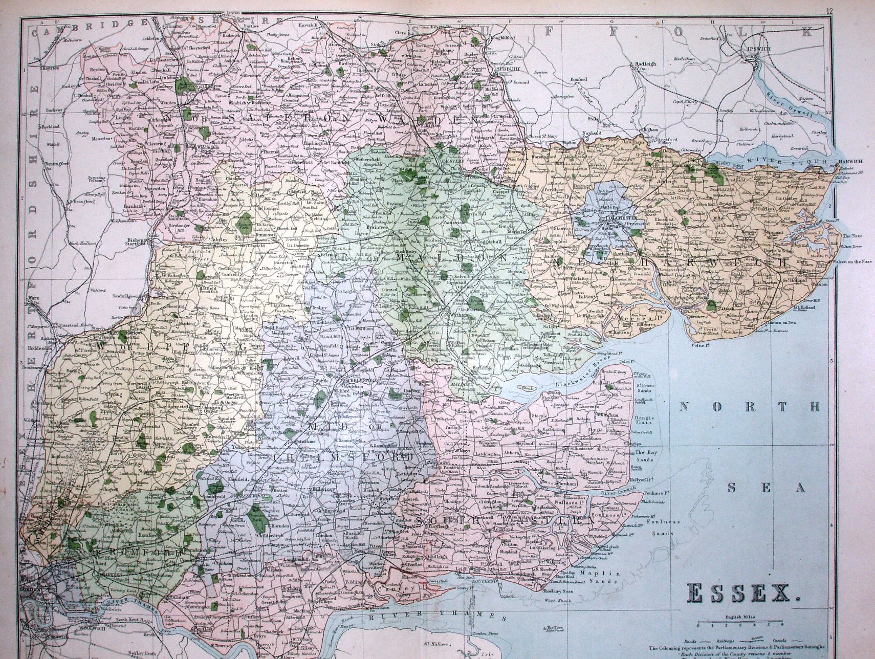
The new Parliamentary Divisons of 1885 are separately coloured, plus frequent green areas for parks/estates - something of a throwback to 100 years earlier as a presentation.
Other examples of this map are 1867 and 1900.
Scale correct at 6 miles = 43.5mm, or 3.5 miles/inch, ie 1:225,000.
The railway to Shoeburyness is shown (opened 1884) and Barking to Upminster (opened 1885), plus many more lines that opened later shown with a dotted line (eg Upminster to Laindon 1886 and the Wickford lines 1889).
Whilst classed as 1885 given the Parliamentary Divisons and railway lines, the 1885 copy of the Atlas held at CUL has the same number of completed lines but has none of the dotted proposed lines - so the copy above must be slightly later than 1885; the next known issue of the Atlas is 1889 which would seem too late for this copy though.