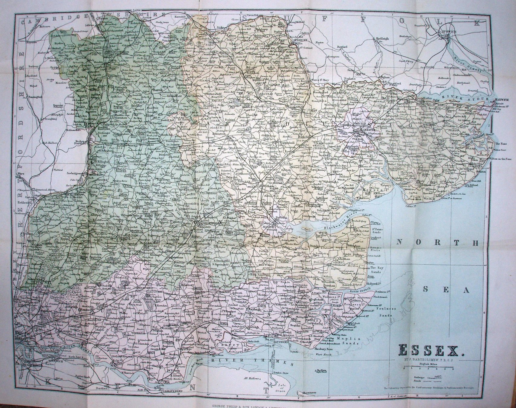
Philip's New Series of County Maps - Essex
The three Parliamentary Divisions are coloured, which does not seem of great relevance to cyclists. This was of course just the standard Philips larger map, as used in Atlases, put in covers and entitled for cyclists. There is absolutely nothing added (such as steep hills or facilities) relevant for cyclists.
Advert for Philip' County Maps of England & Wales inside the cover.
Scale correct at 6 miles = 43mm, or 3.5 miles/inch, ie 1:225,000.
Addresses: 32 Fleet Street London, and Caxton Buildings South John Street and 49 & 51 South Castle Street Liverpool.
The railways include the Central Woolwich extension (opened 1880) but not the Thorpe-le-Soken line to Clacton (opened 1882).