Touring Maps of Great Britain & Ireland, No 15
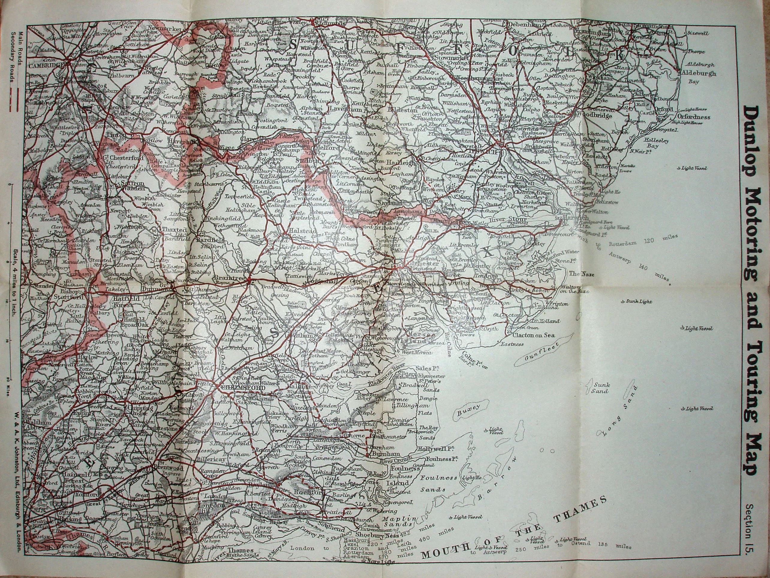
Dunlop Motoring and Touring Map, Section 15 (viz most of Essex, South Suffolk and SE corner of Cambridgeshire). Map by W & AK Johnston, Ltd, Edinburgh & London.
Shows Main roads in solid red and Secondary roads in dashed red, with (implicitly) other roads in black.
Scale correct at 20 miles = 127mm, or 4.0 miles/inch, ie 1:250,000.
Counties edge-coloured. Has got Tollesbury Pier (opened 1907), but not Thaxted branch (1913); has got Southend Arterial (1925), but not Stanford-le-Hope bypass (1929/35) or East Ham bypass (1928), and hence estimated date.
The roads are far more up-to-date than the railways, which suggests the producer of the underlying map was concentrating on the modern changes.