Maps printed after 1954 are not displayed.
 1977 1990
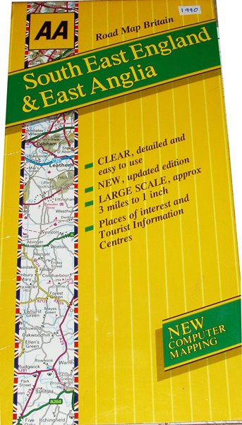
The 1977 map was a three miles to the inch by Geographia, with a grid and an Index to the places on the reverse of the sheet. It extends north-west to Higham Ferrers, north-east to Yoxford, south-east to Sheerness and south-west to Windsor. On the reverse is a large Index, plus an index map showing the 23 sheets covering England, Scotland & Wales. The M11 is shown open from junctions 4 to 8 (opened 1977) but north of there only projected (opened 1979); in the bottom left is print code N.LL - meaning September 1977.
Scale correct at 25 miles = 211mm, or 3.0 miles/inch, ie 1:190,000.
The 1990 map describes itself as "approx 3 miles to 1 inch", but is "New Computer Mapping" and is a larger sheet and printed double sided, so overall it extends north-west to Newark, north-east to Boston (and north Norfolk coast), south-weat to the Isle of Wight. The maps cover England, Scotland & Wales in just 7 sheets. The printing on the map is clearer than in 1977 - partially as they now omit all green (woodland, etc) patches. The map is copyright 1990.
Scale correct at 10 miles = 80mm, or 3.2 miles/inch, ie 1:200,000.
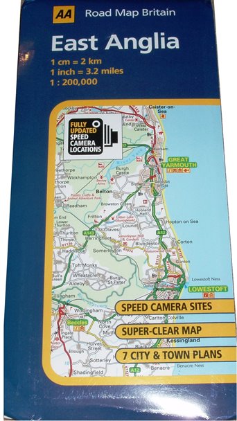 2008 2009
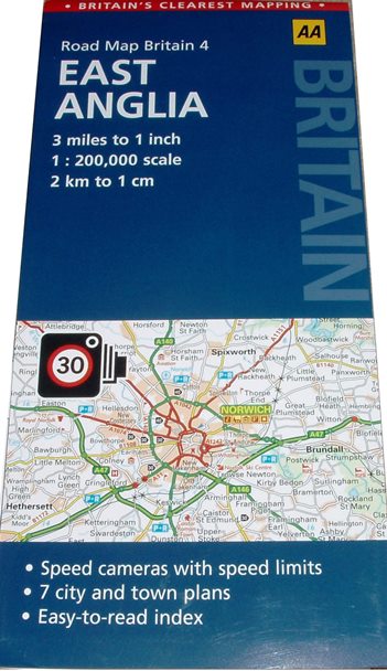
Eventually the AA admits to having gone metric, and using 1:200,000 as a scale - as in 1990. The front cover gives the scale in both metric and imperial, plus the ratio; it also proclaims its "Speed Camera Sites". There is a grid with a gazetteer on the reverse, plus seven town plans.
The map extends north-west to Lincoln, south-east to Southminster and south-west to Thame. It is sheet 4 of a 10 sheet series that covers England, Scotland & Wales, but they must vary greatly in sheet size and/or scale, as (eg) there is one map for the whole of Scotland and the Borders of England.
The 2008 and 2009 editions are very similar, the main differences being the cover designs.
Stated scale of 10 miles = 80.5mm, or 3.2 miles/inch, ie 1:200,000.