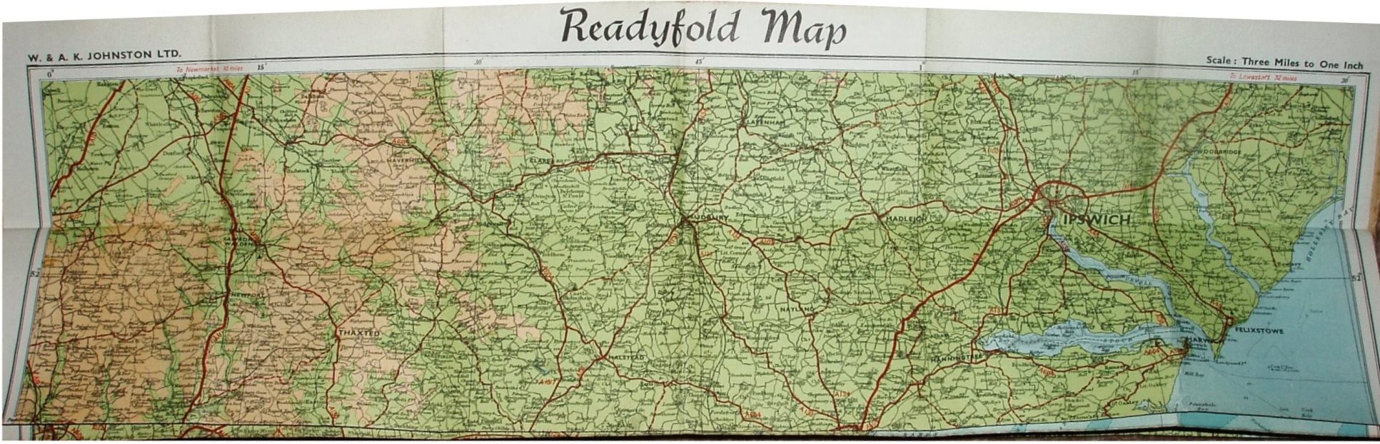
Johnston's Readyfold Coloured Touring Map, Section 1
North-west to Meldreth, north to Shelford, north-east to Woodbridge, east to all of east Kent, south to Beachey Head, south-west to Newhaven, west to West Ham.
Scale correct at 10 miles = 84.3mm, or 3.0 miles/inch, ie 1:190,000.
First class roads in red (numbered), secondary in dashed red; sea in blue, but rivers in black. Published by W & AK Johnston Ltd, 30 Museum Street London, WC1, and Edina Works, Edinburgh.
Code: 1-3/Y = ???; 1947 per seller.