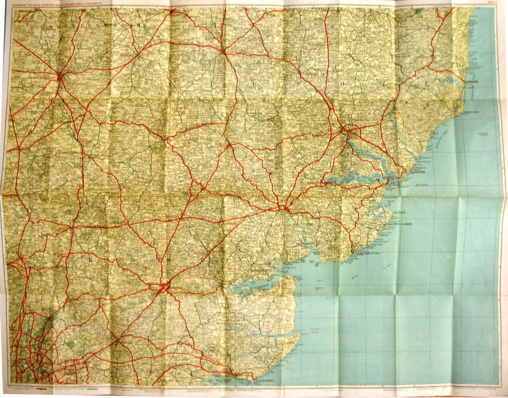
Geographia Two Miles to One Inch Map of England & Wales (in 19 Sheets) - Sheet 14
The same map is used within three wrap-around card covers, all with stuck-on labels for Title and sketch map of area covered:
- Blue cover. On cloth 5/6 Net. Label also stuck on for price .
- Sandy cover. On Paper 2/6 Net (On cloth 5/6 Net).
- Pale green cover. On cloth, 5/6 Net.
The Southend Arterial (opened 1925), Chelmsford bypass (1931) and Stanford-le-Hope bypass (c1932) all open, but no Barking bypass (1928).
Displayed scale of 6 miles = 76mm, or 2.0 inch/mile, ie 1:126,720.
Ministry of Transport Class 1 (A) roads in red with numbers; Ministry of Transport Class 2 (B) roads in green, unnumbered; other secondary rioads in dashed green. No symbols for Steep ascents/descents, or for Golf Links.
Geographia Ltd's address is 167 Fleet Street on the maps but unnumbered on the covers. No code.