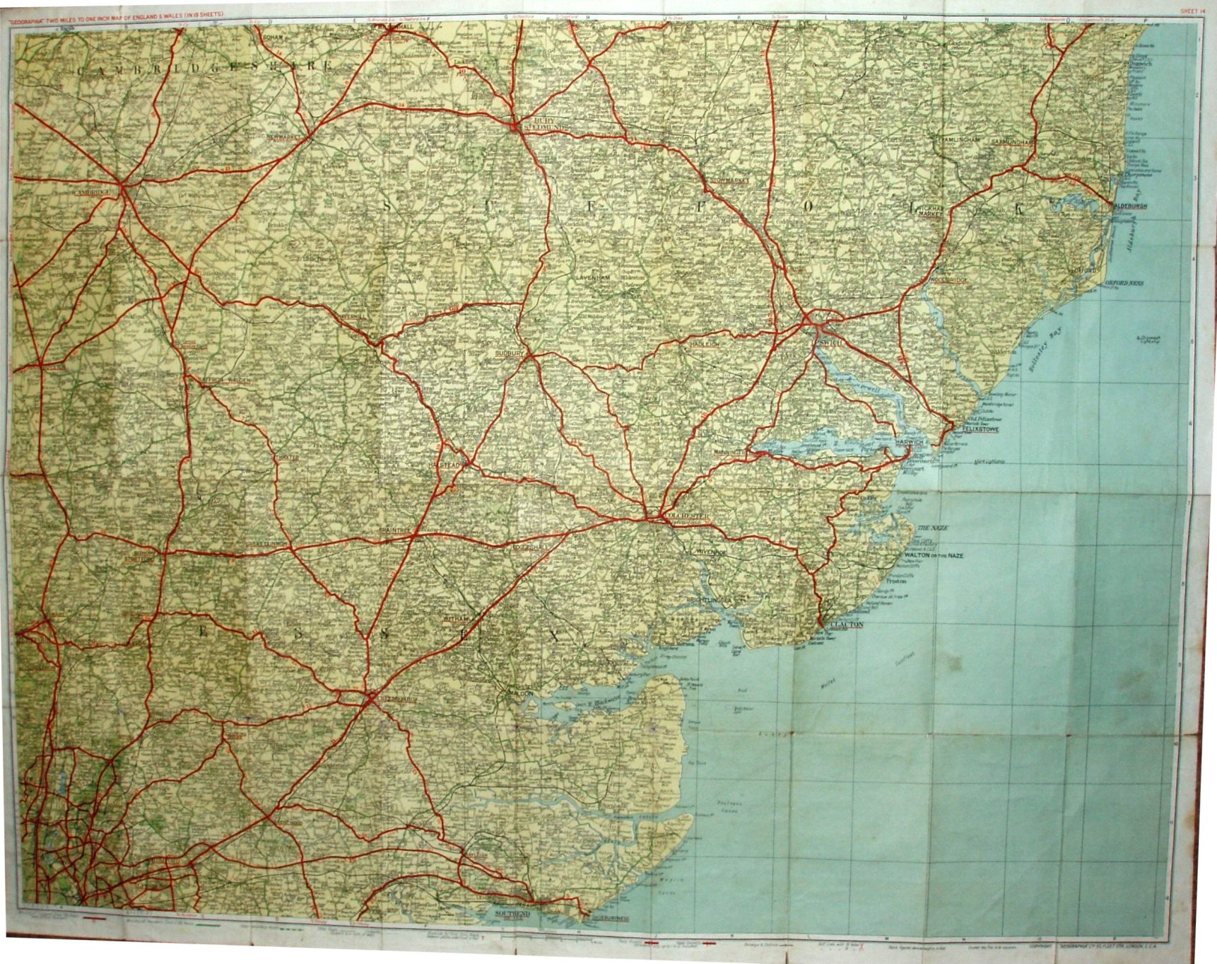
Geographia Two Miles to One Inch Map of England & Wales (in 19 Sheets) - Sheet 14
Dark blue cover, showing side supports of stylised lines. On cloth 3/6 Net (dissected 5/- Net). Labels stuck on for No 14 Essex and South Suffolk and for sketch map of area covered. Front and back covers stuck to cloth.
The Southend Arterial (opened 1925) open, but no Barking bypass (1928), Chelmsford bypass (1931) or Stanford-le-Hope bypass (c1932).
Displayed scale of 4 miles = 50mm, or 2.0 inch/mile, ie 1:126,720.
Ministry of Transport Class 1 (A) roads in red with numbers; Ministry of Transport Class 2 (B) roads in green, unnumbered. Has symbols for Steep ascents/descents, and for Golf Links.
Company name is back to just Geographia Ltd, and address is 55 Fleet Street. Code of D.UN = 1929.