Curiosities of Great Britain, England and Wales Delineated
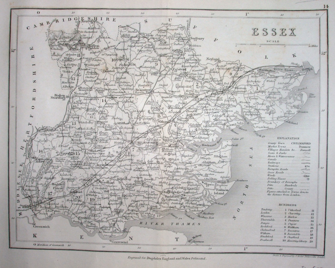
Dugdale's Curiosities of Great Britain, England & Wales Delineated was first published in 1835 using the Cole & Roper 1810 maps; in its 1842 reissue (and later) it used J Archer maps instead, and also from 1854 to 1860 in 50 weekly parts. Dugdale is named bottom centre, Archer's imprint is in the bottom right, and there is a small 14 in the top right.
Scale correct at 15 miles = 53.2mm, or 7.1 miles/inch, ie 1:445,000.
This is from the 1843 re-issue (with an 1842 map), showing the railway line north as far as Bishops Stortford (opened 1842), but not beyond (the line up to Newport opened in 1844). On the Colchester line the railway is shown as far as Colchester (opened 1843), and also rather schematically beyond that to the unlikely destination of Shotley Point (ie unlike on the "1840" version).
At least the fictitious line to Thames Haven is absent.