Black's Handy Atlas of England & Wales
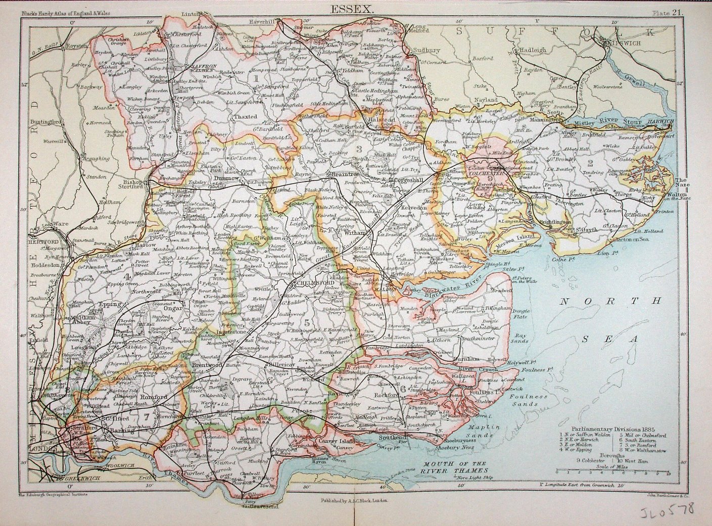
A very clear map, with bright colours for the (1885) Parliamentary Divisions. As well as the Atlas title, around the map are "Plate 21", "Published by A & C Black, London" and "John Bartholomew & Co"; it is the same underlying (Bartholomew) map as used in the Encyclopaedia Britannica 9th edition (the preceding map).
Scale correct at 10 miles = 40.7mm, or 6.2 miles/inch, ie 1:395,000.
The Railways include Grays Thurrock to Upminster (opened 1892) and Upminster to Romford (opened 1893), but not the Forest Gate to Tottenham link (opened 1894).