Maps printed after 1957 are not displayed.
 1964
1964 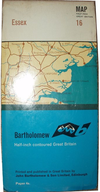 1967
1967 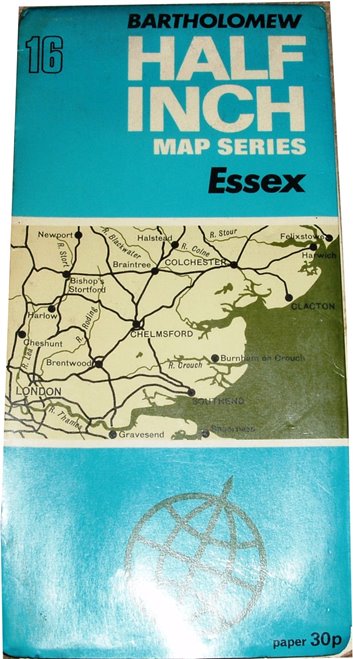 1970
1970
The 1964, 1967, 1970 and 1973 are all: Bartholomew's Revised Half-Inch Map - Essex - Great Britain Sheet 16, with a sketch map of the area covered on the front coloured cover. All also have the phrase: Reduced by permission from the Ordnance Survey with local revision to the date of publication 1964/1967/1970/1973.
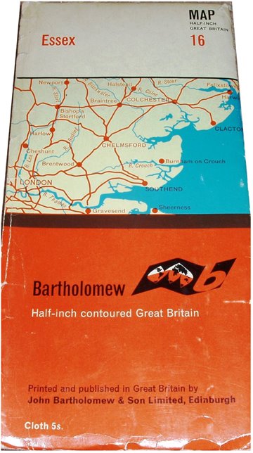
The 1964 map is on cloth, Price 5s Net, N. Weald and Hornchurch aerodromes have gone, but Stapleford Tawney has been added.
The 1967 map is on paper, but one copy is Price 3s Net and a 2nd copy is Price 4s Net. Same symbol as in 1964, but now called Airfields in the key.
The 1970 map is on paper, Price 30p. Same airfields as in 1967, but there is now a large "Danger Area" across Maplin and Foulness Sands.
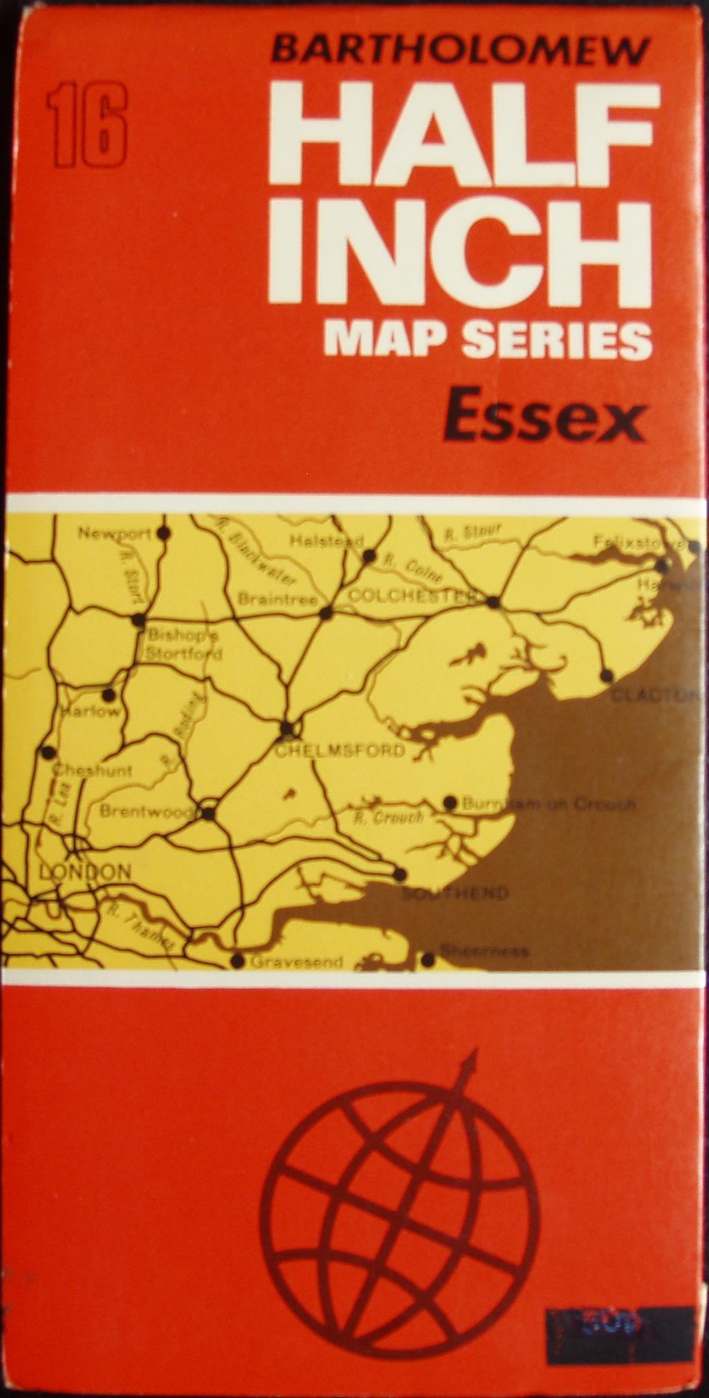
The 1973 map is on paper, Price 50p - that has been (partially) blacked-out. Other than the bright orange cover, all that has changed is the planned M11 ("Open 1975").
They all have a correct scale of 10 miles = 126.5mm, or 2.0 miles/inch, ie 1:126,720.
 1973
1973 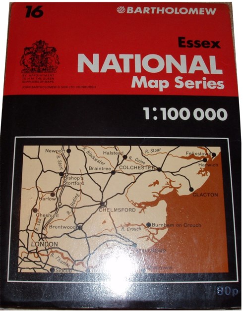 1975 1990
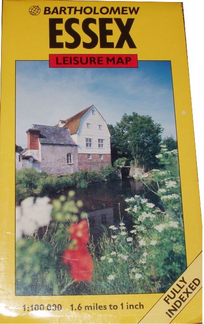
Eventually Bartholomews goes metric, and we get: Bartholomew's 1:100,000 Map of Britain - Essex - Sheet 16.
The 1975 map is on paper, Price 80p. There is a sketch map of the area covered on the front coloured cover, which is wider and shorter than before. The map covers the same area as when they were the half-inch series, but as it is now a larger scale it's a larger map whilst the same sheet number. Different colouring and symbols from 1970, eg the symbol for Airfield is now a jet aircraft, but Stansted's symbol is just in the middle of a large field. The M11 is only built from Harlow to Bishops Stortford, and proposed further south and further north.
The 1990 map is on paper, Price £2.95. The sketch map has been replaced by a pretty picture, plus the rebranding as being a Leisure Map. It's the same coverage as before, but there are many leisure interest symbols with lots of places, plus an index to place names across the bottom of the map. Stansted airport's symbol is still just in the middle of a large field; Rochford airport is now labelled as Southend. The M11 is now fully built.
The two metric maps have Scale correct at 10 miles = 160.4mm and 5 miles = 80.5mmm respectively, or 1.6 miles/inch, ie 1:100,000.