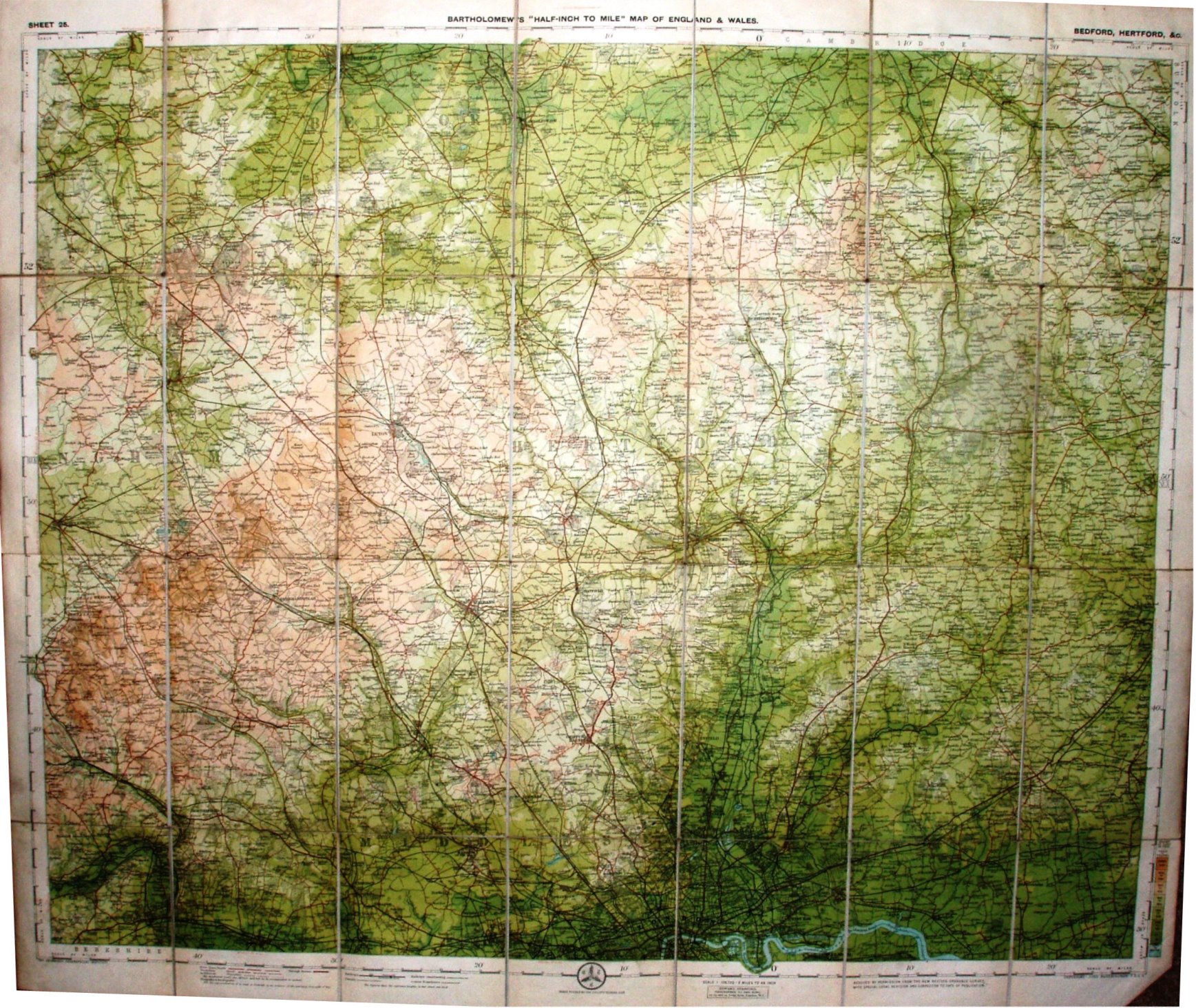
Sheet 25 - Bartholomew's "Half Inch to Mile" Map of England & Wales - Bedford, hertford, &c
All three covers seem to contain the same map (I haven't found any differences on the details portrayed on the maps), but they are three separate productions.
Scale of 10 miles = 127.1mm, or 2.0 miles/inch, ie 1:126,720.
All have the CTC roundal, and Roads revised by The Cyclists Touring Club. Copyright - John Bartholomew FRGS.
The railway lines include the Chigwell Loop line (opened 1903) but not the Thaxted branch (1913).
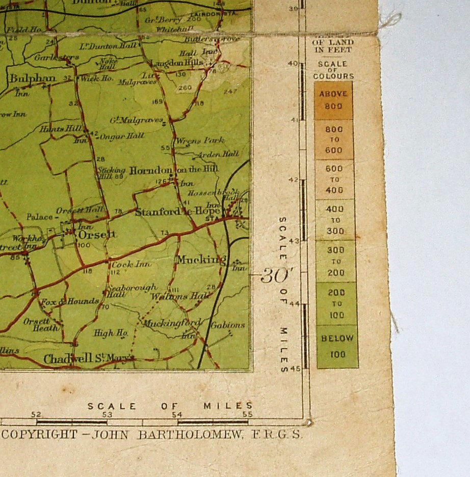 no water depths with water depths
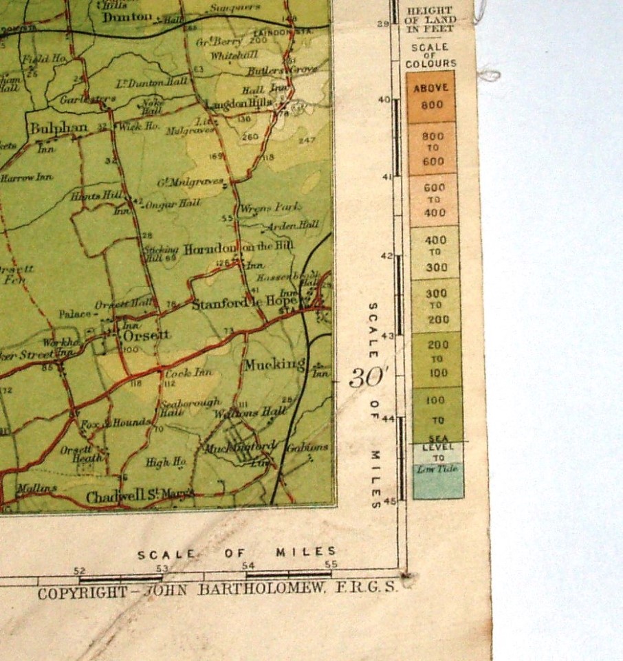
The first one has "Park Road" on its cover, an address that Bartholomew's moved from (to Duncan Street) in 1911. It has two pages of yellow adverts, including the half inch maps of England & Wales priced at 1/- Paper, 2/- Cloth and 2/6 Dissected - prices that were in force until during 1912. Its diagram of land height colouring has land heights but no water depths (see picture). The back cover has an advert for their 4 Miles to the Inch maps of England & Wales (in 12 sheets); it is a blue wrap-around style of cover.
The second one has no address on its cover (other than Edinburgh), so presumably after their move to Duncan Street in 1911. It has two pages of yellow adverts, including the half inch maps of England & Wales priced at 1/6 Paper, 2/- Cloth and 2/6 Dissected - prices that came into force during 1912. Its diagram of land height colouring has land heights and water depths (see picture). The back cover has an advert for their many types of Atlas; it is a blue wrap-around style of cover.
The third one has no address on its cover (other than Edinburgh), so presumably after its move to Duncan Street in 1911. It has two pages of yellow adverts, but for various Touring maps; the back cover has an advert for the half inch maps of England & Wales priced at 2/- Cloth and 2/6 Dissected - prices for those two styles (it does not mention a Paper price) that applied from 1898 to 1918. Its diagram of land height colouring has land heights and water depths (see picture). The map has a code: "B11", meaning 2nd half of 1911 - when they introduced the code dating. The blue cover is separately attached as sheets to the front and back of the folded map.
Given the lack of evidence, and indeed conflicting evidence, I estimate the following publication dates - even though it is the same map:
- the first 1904 to 1910;
- the second in 1912, despite the lack of a date code, simply because of the prices (using up old stock?);
- the third also in 1912, but using a more recently printed map (the code is a print date, not a publication date).