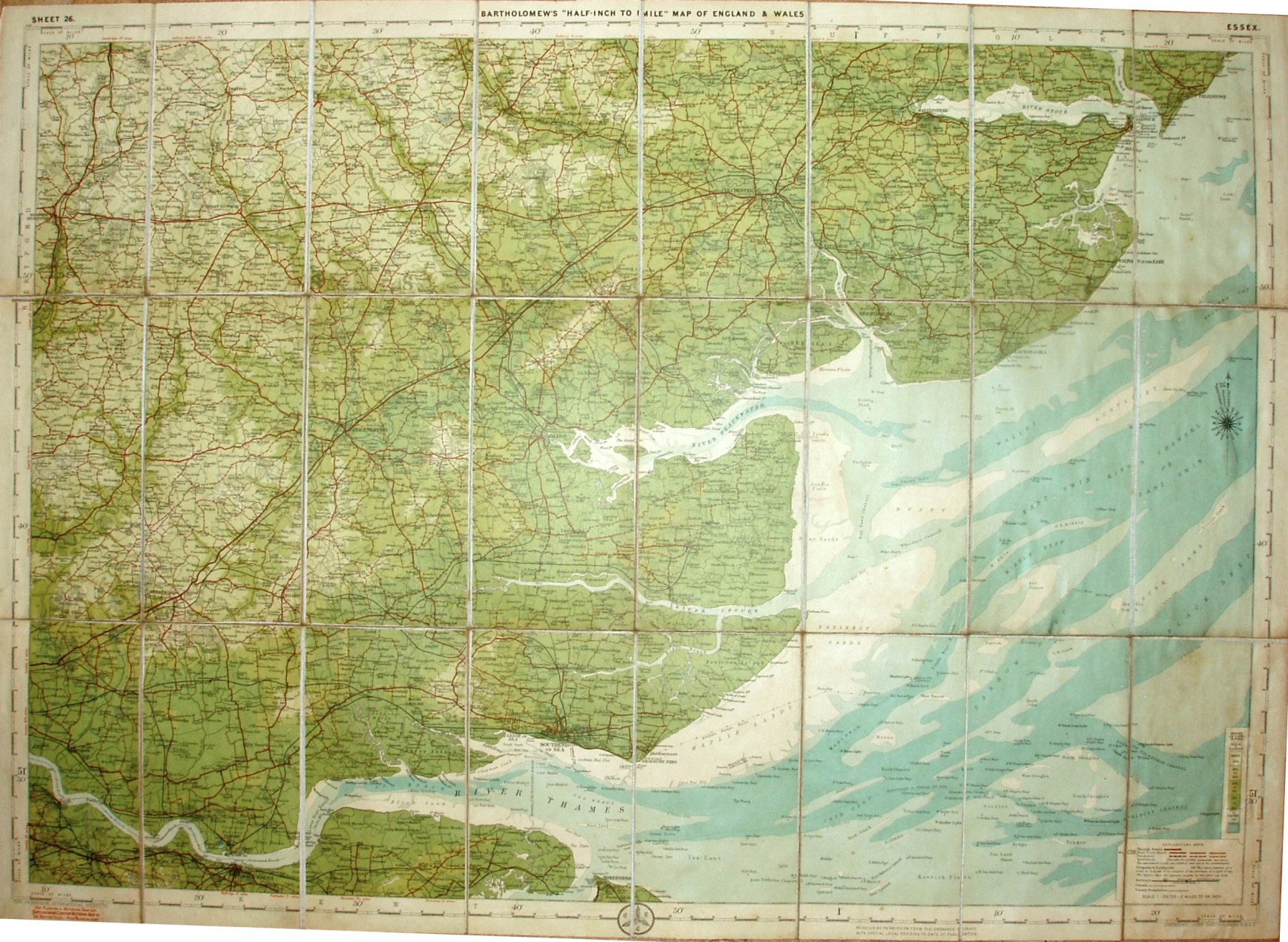
Sheet 26 - Bartholomew's "Half Inch to Mile" Map of England & Wales - Essex
All three covers dated 1920 have the same map, but the cover and map dimensions vary a little:
Bartholomew's is 516 x 727mm in a cover 189 x 96mm;
J&H Bell's is 516 x 727mm in a cover 192 x 97mm;
Forster Groom's is 522 x 740mm in a cover 200 x 98mm.
Explanatory note in the bottom right corner that defines Through Route, First Class, Secondary (Good) and Indifferent (Passable to Cyclists) classes of roads.
Scale of 10 miles = 127.1mm, or 2.0 miles/inch, ie 1:126,720.
Roads revised by The Cyclists Touring Club. John Bartholomew & Co.
The Bell edition has a plain cover, with 26 & Essex hand written on a pasted sheet of J&H Bell, Nottingham. Describes the map as "Bartholomew's Reduced Ordnance Survey" - but it became the "New Reduced" in 1904, so is Bell using an old stock of labels?
The Forster Groom edition is Dissected on cloth, price 4/-, in heavy blue boards with their label attached, referring to Bartholomew's New Reduced Survey.
Map has code A20, ie printed first half of 1920.