Maps printed after 1970 are not displayed.
1979 1981 1983 1984
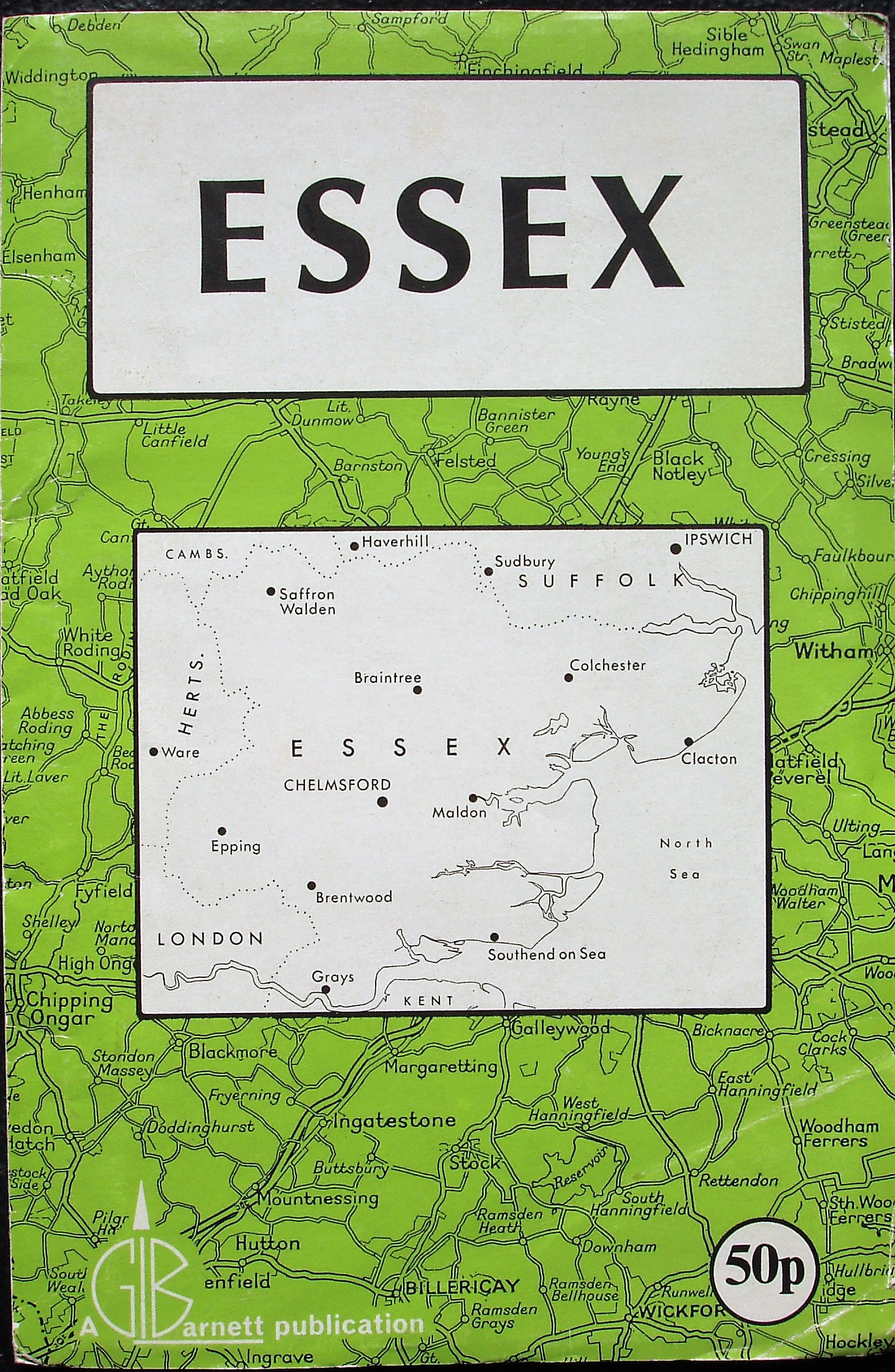
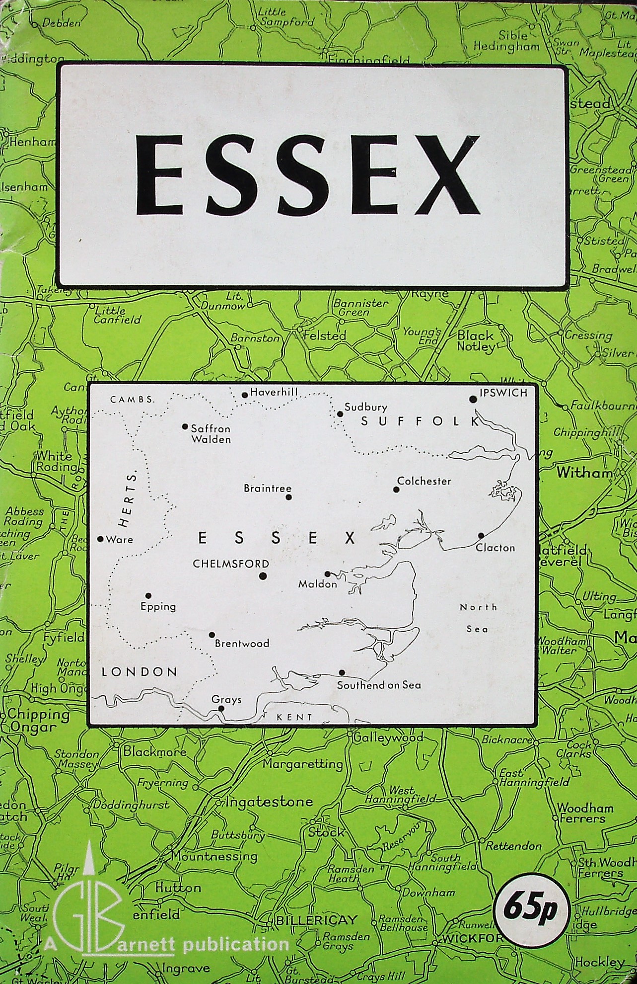
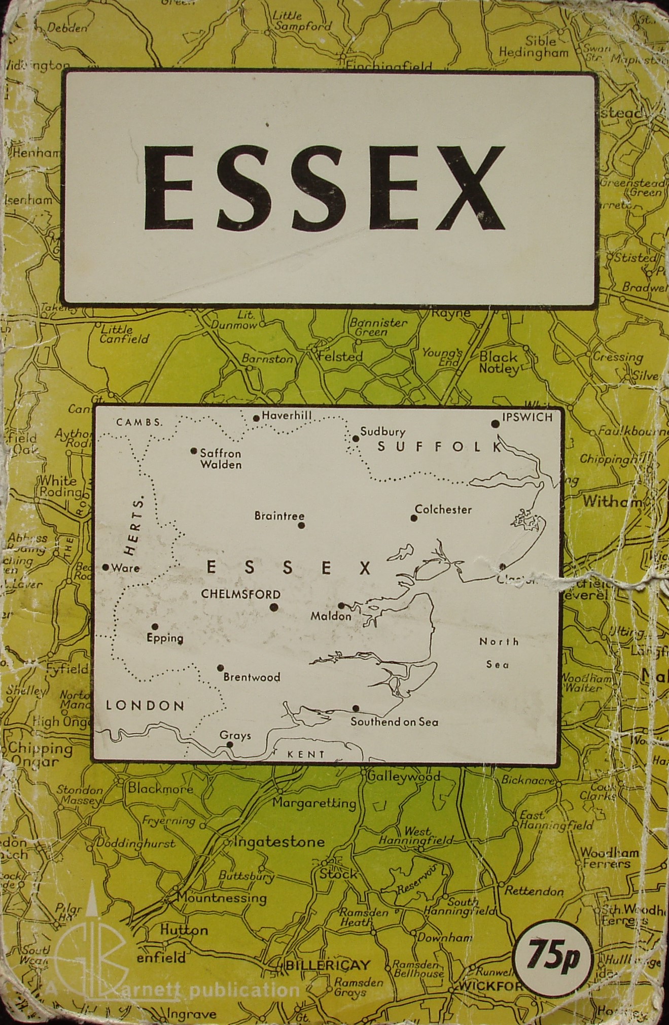
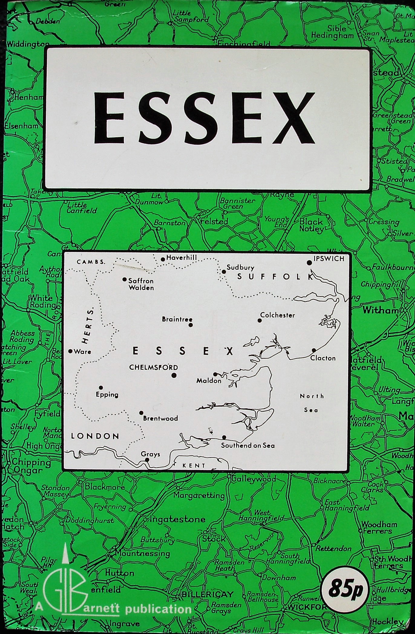
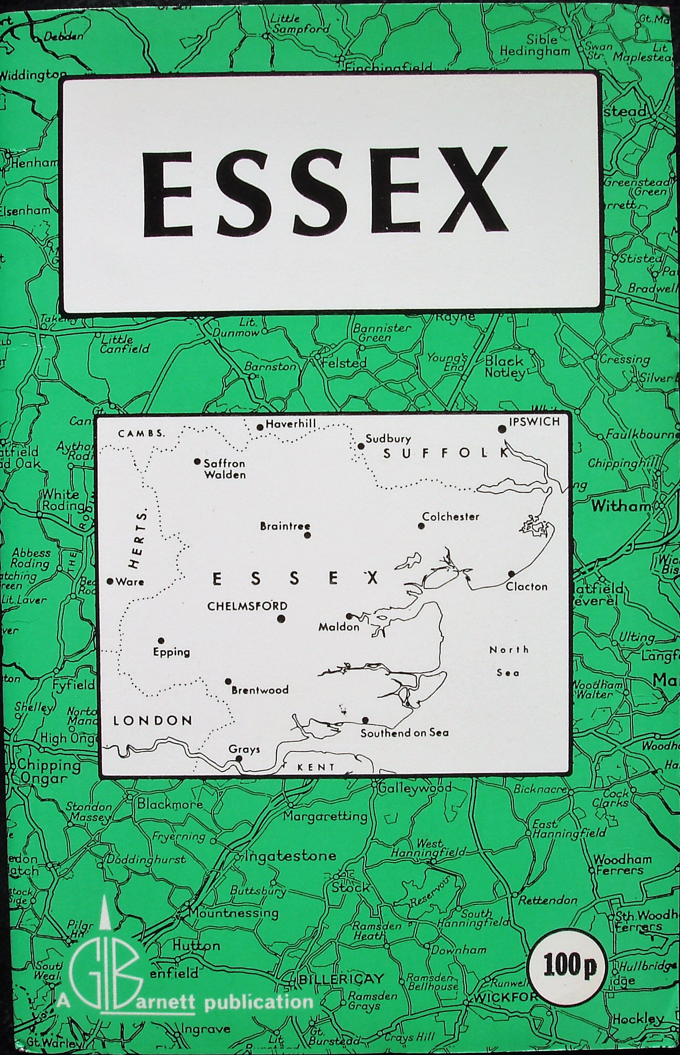
Both the cover design and the map change in 1979. The cover has a sketch map of the county in the centre, with just "Essex" as its title. The cover colour is generally green, possibly varying in shade or maybe just faded over time. The main change in the cover over time is the price.
There is a new colour scheme on the maps too - Motorways are cased in blue, Trunk roads in wide cased red, A roads in cased red, B roads in cased yellow, and double black lines for other roads. There is also a dash-dot plus edge-colouring for the county boundary and a red aircraft symbol for Airfield; the sea is now in blue.
The first map is priced at 50p. The M11 is shown open from J4 to J10 at least (opened 1980 north of J9), but there is no M25 planned. Place names are keyed to squares on the reverse in a short Index (that no longer has any information on places); town plans of Colchester, Chelmsford and Romford area. There are adverts around the map, plus more on the reverse. As M25 construction eastwards from J29 started in 1979, I estimate 1979 for this map.
The second map is priced at 65p. M25 is shown as projected J26 to J27 (construction started 1981), and under construction J27 to the Dartford Crossing (J29 to the Crossing opened in 1982); there is no A12 Orwell bridge (oepened 1982). Place names are keyed to squares on the reverse in a short Index; town plans of Colchester, Chelmsford and Romford area. There are adverts around the map, plus more on the reverse. From the M25 work and Orwell bridge, I estimate 1981 for this map.
The third map is priced at 75p. M25 is shown as under construction J26 to J27 (construction started 1981, opened 1984), and open west of J26 and J27 to the Dartford Crossing (opened in 1982). The Orwell bridge for the A12 is shown (opened 1982). Place names are keyed to squares on the reverse in a short Index; town plans of Colchester, Chelmsford, Basildon, Rayleigh, Southend, Clacton, Harlow, Brentwood, Epping and Romford area. There are adverts around the map, plus more on the reverse. From the M25 work and Orwell bridge, I estimate 1983 for this map.
The fourth map is priced at 85p. M25 is now fully open (J26 to J27 opened 1984). There is no mention of a new A12 by-pass for Chelmsford (opened 1986). Place names are keyed to squares on

1985 1987 1989 1991
the reverse in a short Index; town plans of Colchester, Chelmsford, Basildon, Rayleigh, Southend, Clacton, Harlow, Brentwood, Epping and Romford area. There are adverts around the map, plus more on the reverse. I've estimated this map to be 1984 as it lies between the 1983 and 1985 maps.
The fifth map is priced at 90p. M25 is now fully open (J26 to J27 opened 1984). The new A14 is shown planned to the west of Ipswich, and the A12 Chelmsford by-pass is shown as planned and as marked as "open mid-1986". Place names are keyed to squares on the reverse in a short Index; town plans of Colchester, Chelmsford, Basildon, Rayleigh, Southend, Clacton, Harlow, Brentwood, Epping and Romford area. There are adverts around the map, plus more on the reverse. From the A12 and A14 I've estimated this map to be 1985.
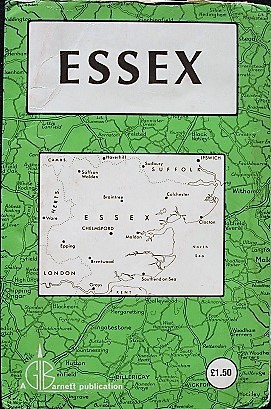
The sixth map is priced at 100p. M25 is fully open; the Chelmsford by-pass is open (opened 1986). The new A14 is shown planned to the west of Ipswich. Place names are keyed to squares on the reverse in a short Index, but there are no town plans and only one advert. Telephone number for their address is still in the 01- format (081- introduced in 1990). I've estimated this map to be 1987.
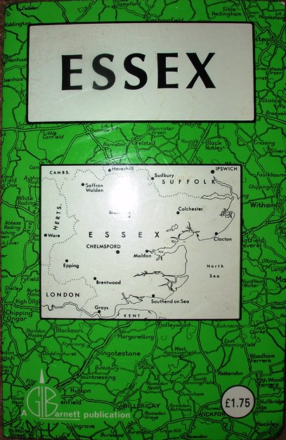
The seventh map is priced at £1.50p. There is a new bypass (the A14) on the eastern side of Ipswich, and the parallel road which used to be marked as the A1100 is now marked as the B1113. Place names are keyed to squares alongside the map in a short Index, but there are no town plans and no adverts; the back is completely blank. Telephone number for their address is still in the 01- format (081- introduced in 1990). I've estimated this map to be 1989.
The eighth map is priced at £1.75p. There is a new bypass (the A14) on the eastern side of Ipswich. Place names are keyed to squares alongside the map in a short Index, but there are no town plans and no adverts; the back is completely blank. Telephone number for their address is in the new 081- format (introduced in 1990). There is a date at the end of the Index (and on the back cover) - 4/91 - which I take to mean 1991.
The address on all the maps is Graphia House, Rippleside Commercial Estate, Barking, Essex.
They all have the Scale correct at 5 miles = 47mm, or 2.7 miles/inch, ie 1:170,000.
 2003
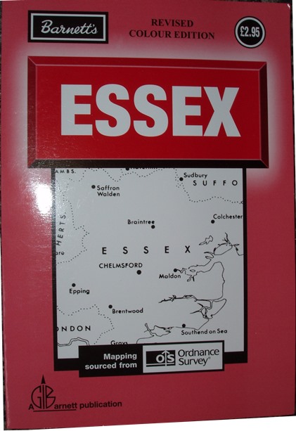
2003Both the cover design and the map change in 2003. The cover has an enlarged sketch map of the county in the centre, with just "Essex" as its title, albeit "Revised colour edition". The Ordnance Survey is acknowledged as their source on the cover too.
There is a new colour scheme on the maps too - Motorways are in blue, Primary Routes in green, A roads in grey, B roads in cased
yellow, and minor roads in black. The county boundary has reverted to just a dash-dot plus line, but neighbourin g counties now have a pale yellow colour wash.
The 2003 map is priced at £2.95. Place names are keyed to squares alongside the map in a short Index, but there are no town plans and no adverts; the back is completely blank. Telephone number for their address is in the new 0208 format (introduced in 2000). There is a print code: BS"D (meaning unknown); dated by supplier as 2003.
The address on all the maps is Graphia House, Rippleside Commercial Estate, Barking, Essex.
It also has the Scale correct at 5 miles = 48mm, or 2.7 miles/inch, ie 1:170,000.