Large Scale Easy to Read Map of Essex
Cover: red text on red background; 12 1/2p. Inside front cover there is an advert for James Abbot Partnership; the back cover has an advert for Wiggines Howes.
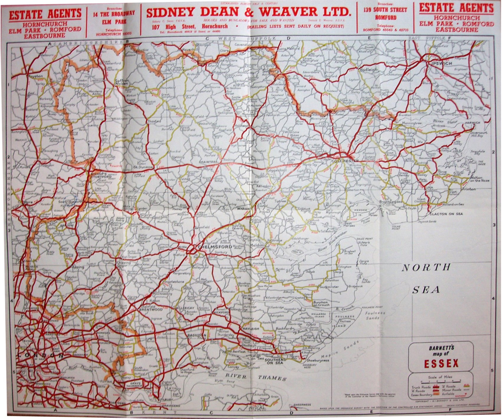
Lettered columns columns and numbered rows form a grid, with an Index on the reverse. For towns this lists info such as Population, Early Closing Day, and distances to London and neighbouring towns; Saffron Walden population stated as 10,050. Copyright GI Barnett & Son Ltd. Based on the Ordnance Survey by the permission of the Controller HM Stationery Office. Crown Copyright Reserved.
Scale correct at 5 miles = 42mm, or 3.0 miles/inch, ie 1:190,000.
Trunk roads in wide cased red, A roads in cased red, B roads in cased yellow, double black lines for Other roads and twin red lines for Proposed roads, and a dash-dot plus edge-coloured line for county boundary and a red aircraft symbol for Airfield. There are no railways shown anywhere at all - none! No motorways shown, not even planned.
Address is Graphia House, Rippleside Commercial Estate, Barking, Essex; no telephone number. From the SW population, I'd date this to c1970.