Large Scale Easy to Read Map of Essex
Cover: green text on green background; 2/-. Inside front cover there is a summary map of the main roads of Essex; the back cover has an advert for Barnett's Street Maps - c260 across England & Wales, and at about twice the price of those listed on the Popular Pocket edition above.
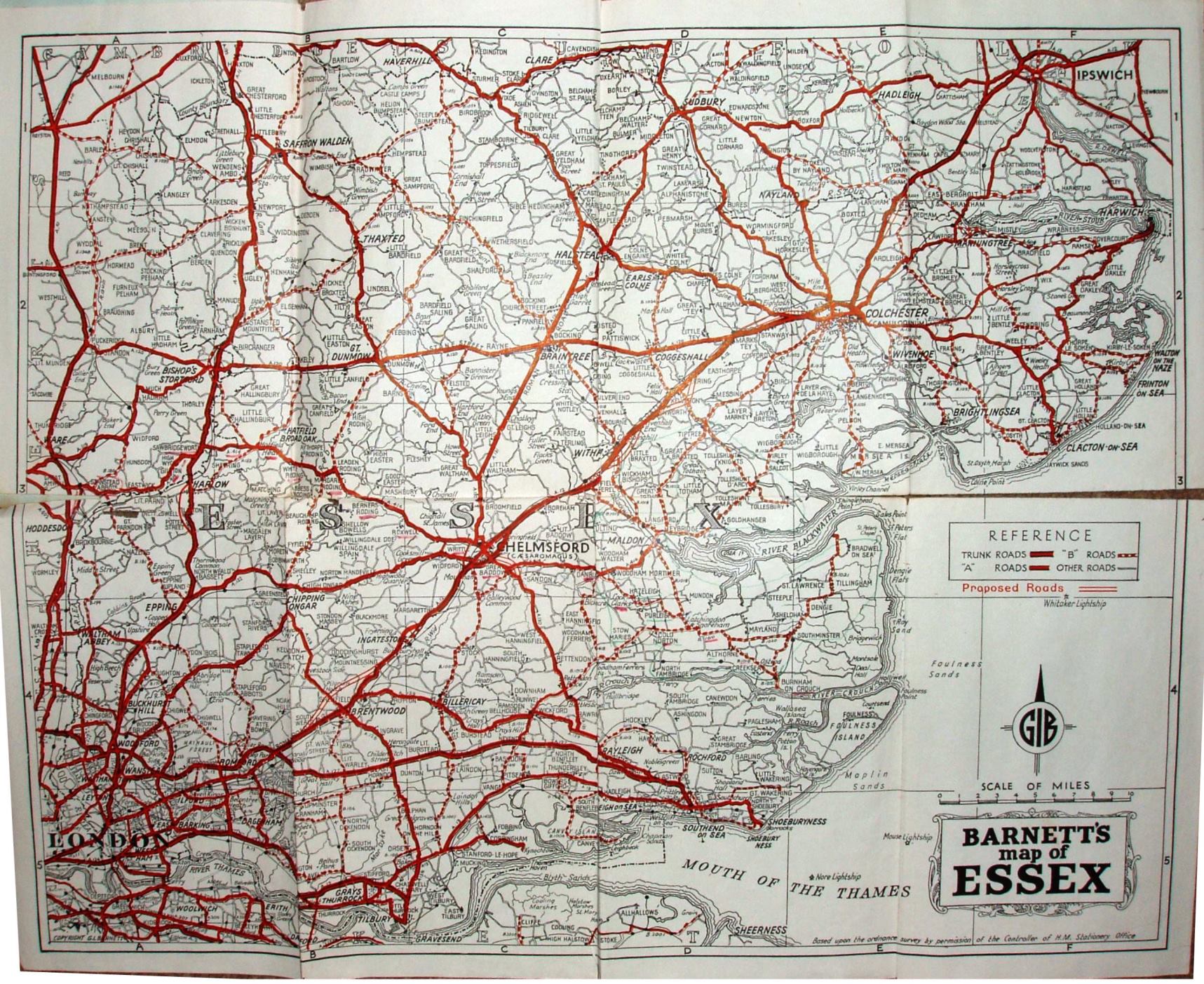
Lettered columns columns and numbered rows form a grid, with an Index on the reverse. For towns this lists info such as Population, Early Closing Day, and distances to London and neighbouring towns; Saffron Walden population stated as 8,350. Copyright GI Barnett. Based on the ordnance survey (sic!) by the permission of the Controllerv of HM Stationery Office.
Scale correct at 10 miles = 86mm, or 3.0 miles/inch, ie 1:185,000.
Trunk roads in thick cased red, A roads in cased red, B roads in cased dashed red, and double black lines for Other roads - plus twin red lines for Proposed roads; Brentwood bypass shown as Proposed (opened 1965). Shows railway line to Tollesbury Pier (swept away by floods in 1953) and railways in Kent.
Address is Rowallan House, Little Heath, Chadwell Heath, Essex, Tel: Sun Kings 7731. From the SW population, I'd date this to c1963.