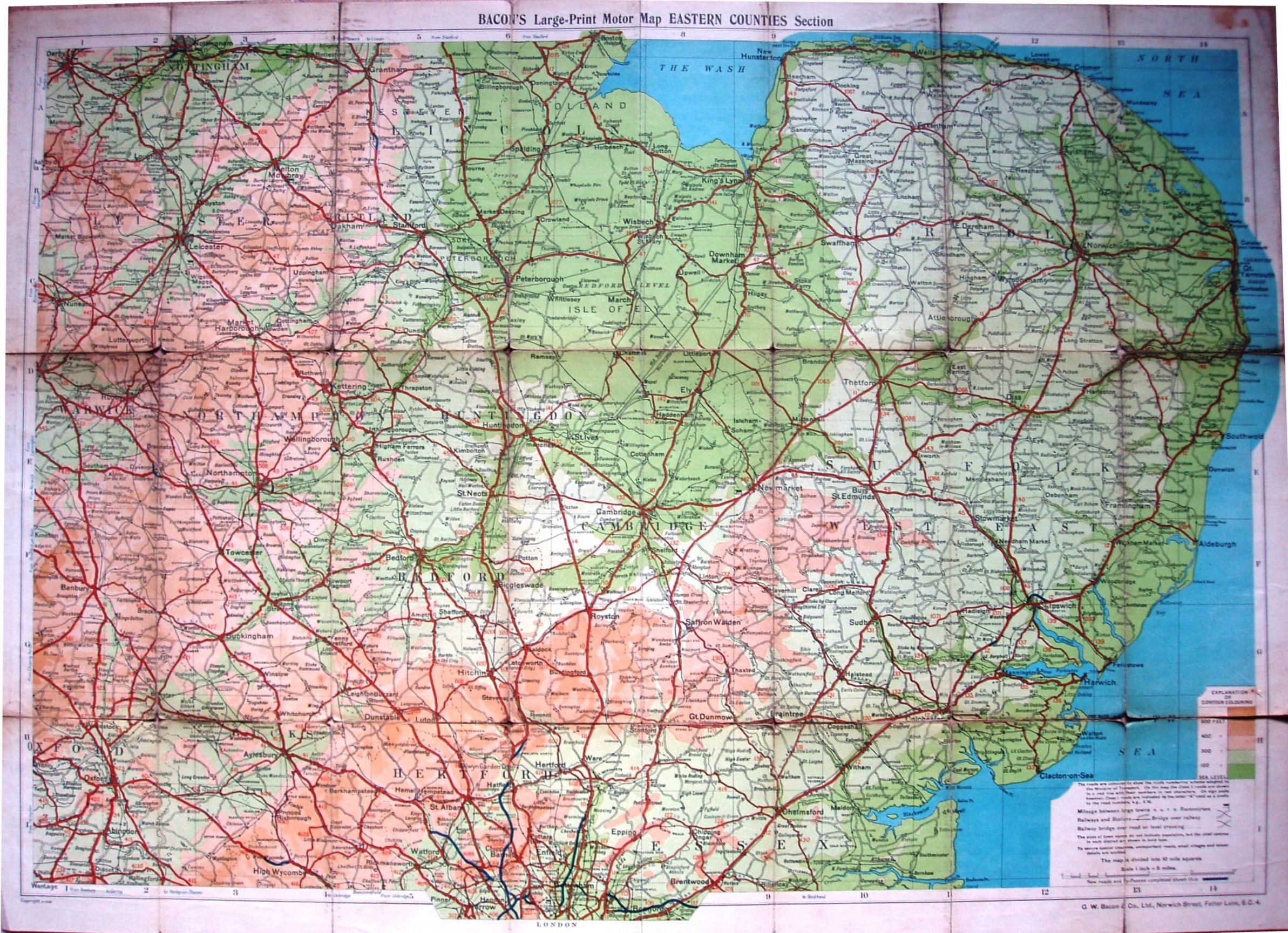
Bacon's Large-Print (5 Miles to 1 Inch) Motor Map Eastern Counties
As well as Essex, we the map extends NW to Derby, NE to Cromer, SE to Southminster and SW to Wantage.
The cover has an outline map of the area covered, both the map and all the text in monochrome. There is no "Index to Places".
Scale correct at 20 miles = 100mm, or 5.0 miles/inch, ie 1:315,000.
The imprint at the bottom is only GW Bacon & Co Ltd, 127 Strand, London (no codes, and no credit to Bartholomews). Major roads are in red (and are numbered), and only some minor roads are shown; distances are marked between towns. Has "New Roads and By-passes" in blue, including western end of Southend Arterial.
The railway lines have Tollesbury Pier (opened 1907) and the Thaxted branch (1913) as open (but no projected lines beyond0.