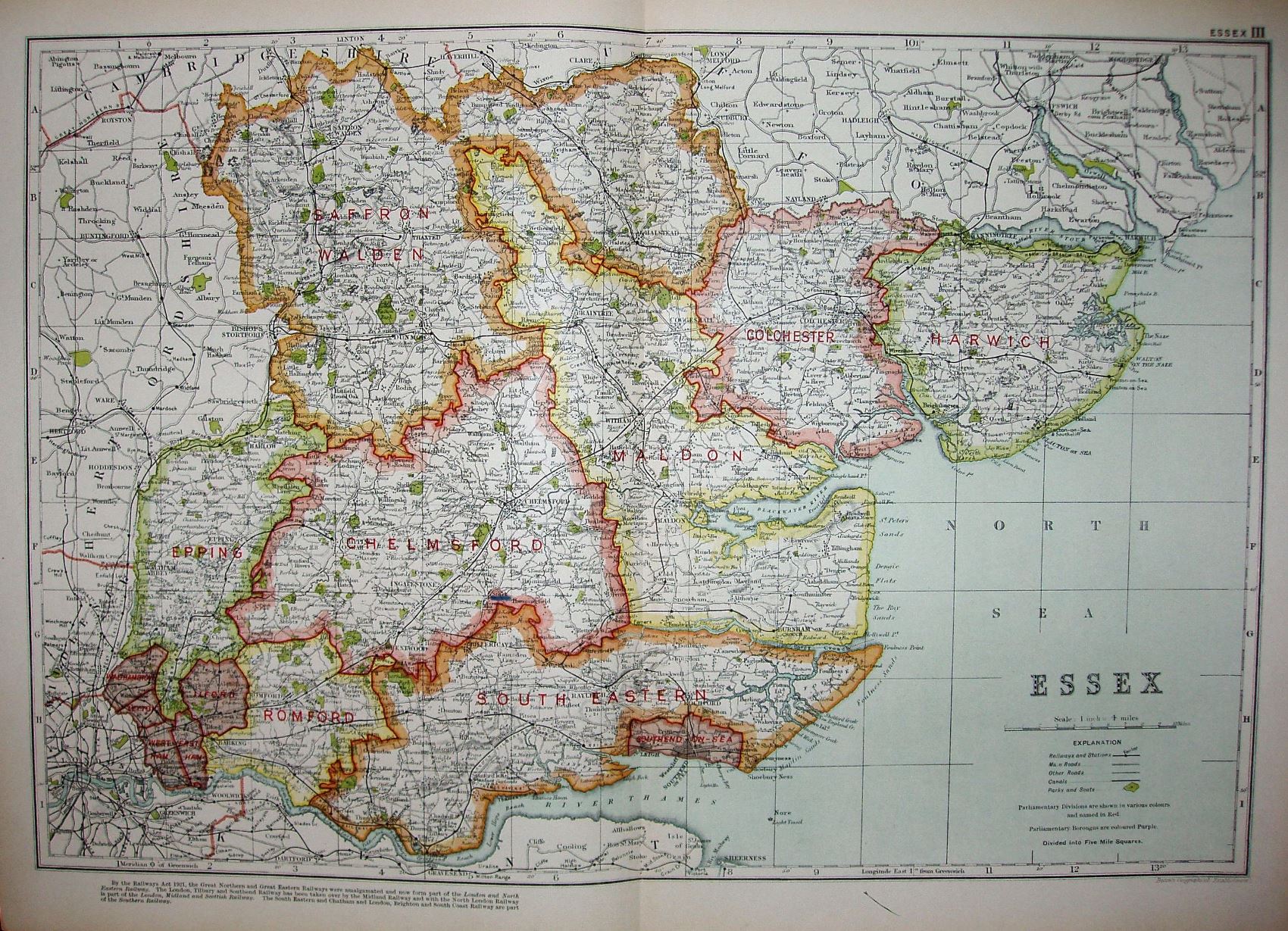
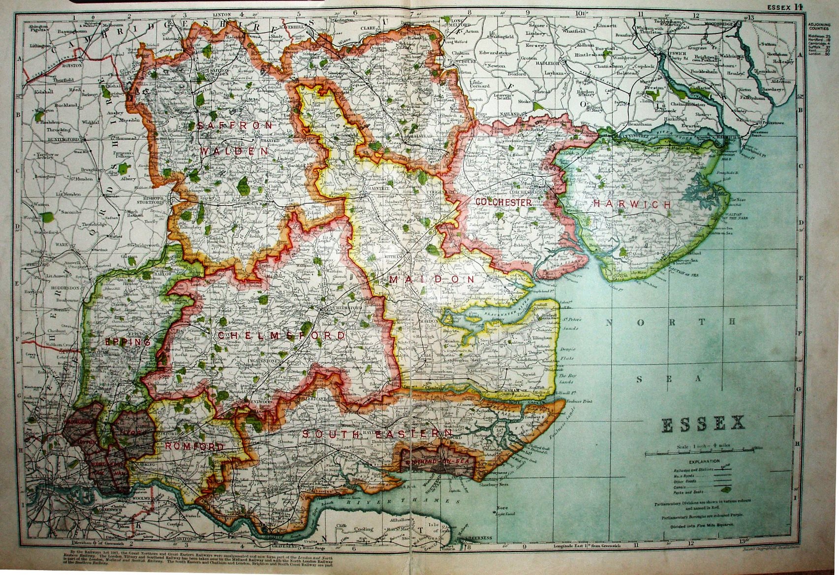
Bacon's County Atlas of England and Wales
These two seem identical, with the exception of the extreme top right corners - the 1st is "Essex III" and the 2nd is "Essex 14" (plus references to adjoining counties). There must therefore either be two atlases or two editions using the same maps. These both have the Hundreds' coloured, unlike the 1913 version.
Scale correct at 10 miles = 63.7mm, or 4.0 miles/inch, ie 1:250,000.
Both make reference to the "Railway Act 1921", whereby the old companies were amalgamated into four Regions. The railways shown were the highwater mark for railway coverage in the county.