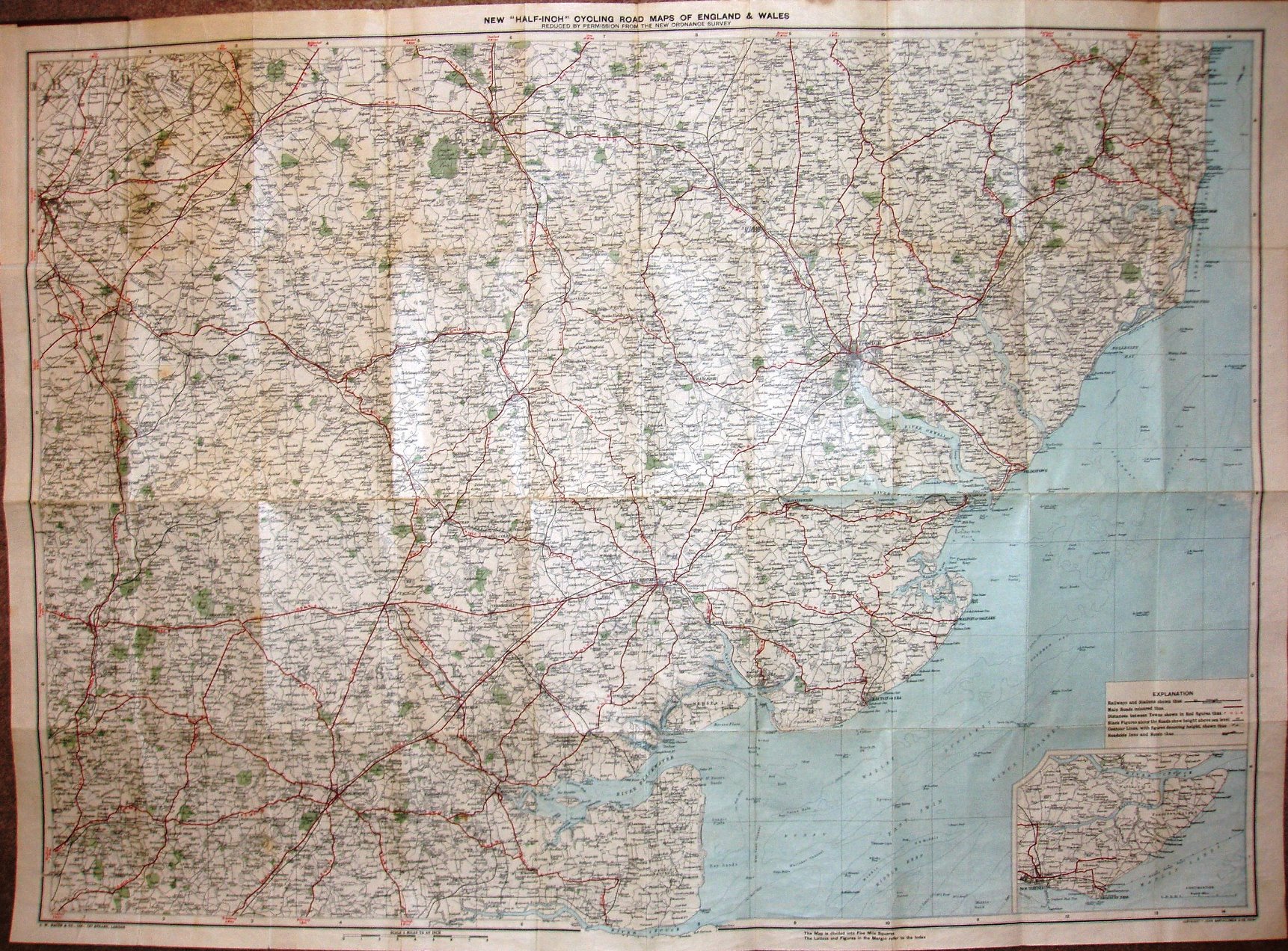
Bacon's Motoring and Cycling Road Map - Colchester District
The map extends north-west to Cambridge, north-east to Saxmundham, south-east to the River Crouch and south-west to Epping.
The cover has an outline map of the area covered, on a brown stiff board cover. There is an "Alphabetical Index to Towns", with 1901 census populations.
Displayed scale of 8 miles = 101mm, or 2.0 miles/inch, ie 1:126,720.
The main roads are coloured red, with distances between places shown in the same way as on the 1910 Eastern Counties map. The imprints at the bottom are GW Bacon & Co Ltd, 127 Strand, London, and also Copyright - John Bartholomew & Co, Edinr.
The railway lines include the Thaxted branch (opened 1913) - but none of the fanciful additional propsed lines beyond there.