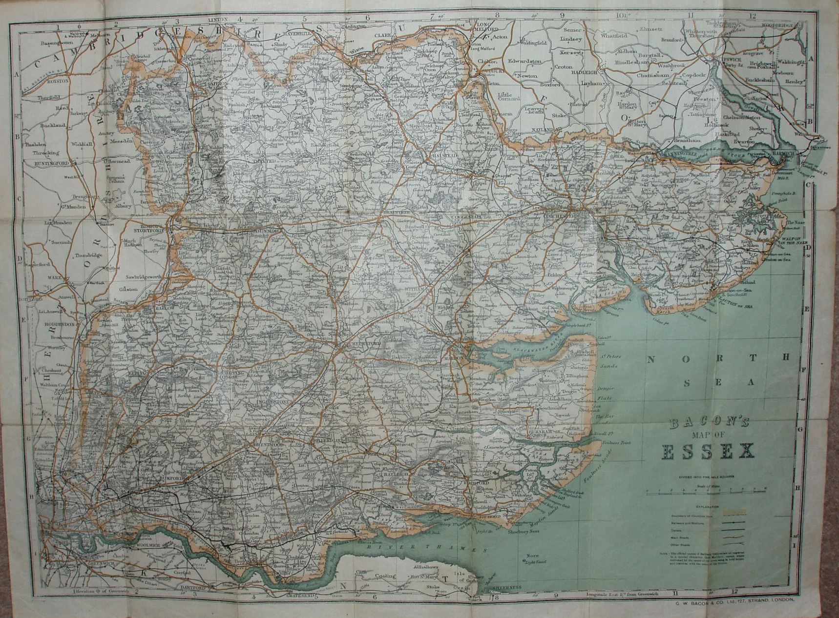
Bacon's County Map of Essex
Folding map with booklet that only has the "Alphabetical Index of Towns, Villages, &c", excluding populations.
Dismounted woman consulting map by a milestone whilst car passes. Dull dun-coloured cover, printed only in black. Main roads in brown, and county edge-coloured in pale pink. Price 6d net; On Cloth 1s net. Has "Bacon's Map of Essex" on cover spine. Advert on back cover listing (county) maps, with prices including option "On Rollers and Varnished 4s."
Scale correct at 10 miles = 94mm, or 2.7 miles/inch, ie 1:170,000.
The reference table has the same 5 symbols as in 1912 version. The railway lines include the Thaxted branch (opened 1913) but also with projected extensions that were never built.
In the bottom left corner there is "Copyright" just visible, but if there were any codes they have been rubbed away.