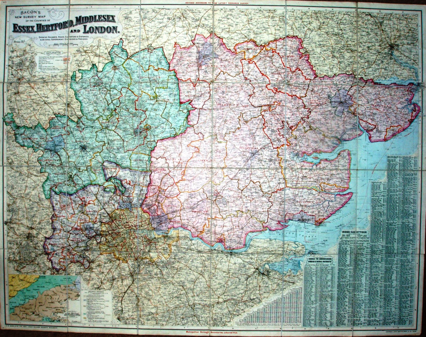
Bacon's New Survey Map of the Counties of Essex, Hertford, Middlesex and London
As well as Essex, we get all of Hertfordshire, Middlesex and London, with an Index to districts and to places, plus a small geological map of the area.
The cover is plain brown board (with a hint of red, but not as much as in the photo), with title embossed in gold. Inside this the map is dissected on cloth, with marbled end-boards.
Scale correct at 6 miles = 76mm, or 2.0 miles/inch, ie 1:127,000.
The imprint at the bottom is GW Bacon & Co Ltd, Royal London Buildings, Deansgate, Manchester, and also Copyright John Bartholomew& Co, Edinr. Price 21/-, not cheap! Populations for counties and places as at 1901.
The railway lines include the line to Tollesbury Pier (opened 1907), but the Thaxted branch (and beyond) is only projected (opened 1913).