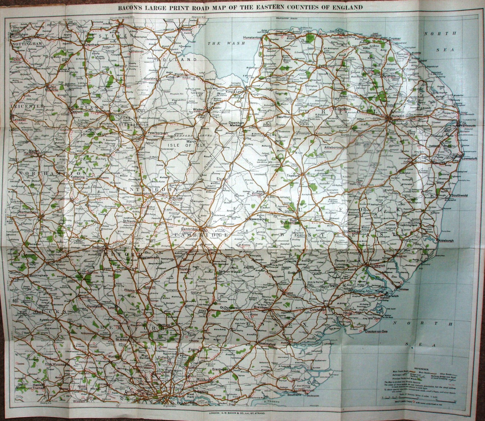
Bacon's Large-Print (5 Miles to 1 Inch) Motor Map Eastern Counties
As well as Essex, we the map extends as far north as Boston, as far north-west as Nottingham and south-west as Henley on Thames.
The cover has an outline map of the area covered, with only "motor Map" in colour (red), on a green fibre board cover. There is an "Index to Places" refering to a list if "Cycling and Motoring Routes", with no populations.
Scale correct at 20 miles = 103mm, or 5.0 iles/inch, ie 1:315,000.
The imprint at the bottom is only GW Bacon & Co Ltd, 127 Strand, London (no codes, and no credit to Bartholomews). Major roads are in ochre (unnumbered), and only some minor roads are shown - the map is far less cluttered (because less detail) than the 1902 version.
The railway lines include the line to Tollesbury Pier (opened 1907), but the Thaxted branch (and beyond) is only projected (opened 1913).