Bacon's New Quarter Inch Maps - Cycling and Motoring, East Anglia
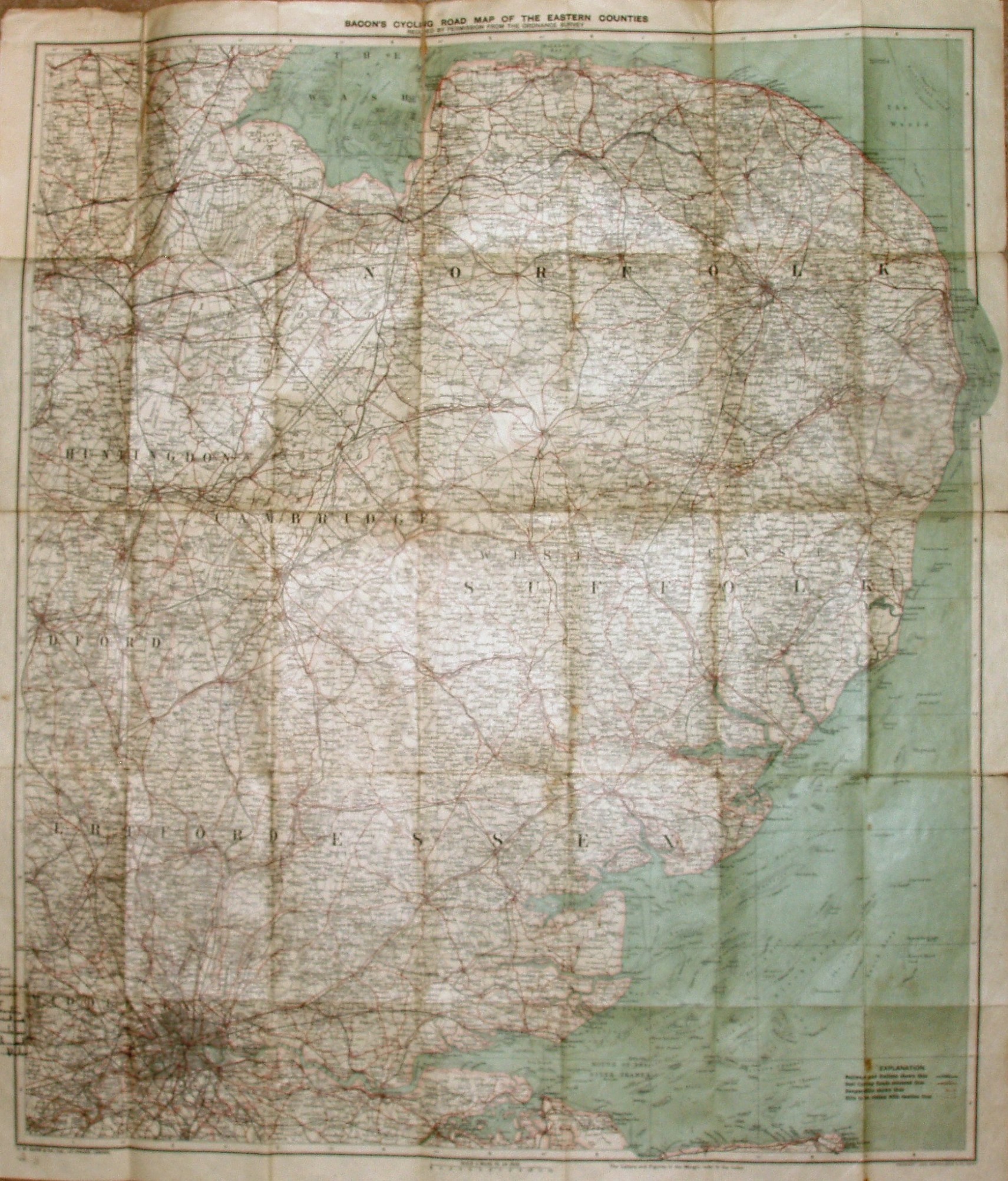
As well as Essex, we get Hertfordshire, Suffolk, Norfolk, Cambridgeshire, Huntingdonshire, London and parts of Bedfordshire, Lincolnshire, Surrey and Kent.
The cover has a man and woman driving their car, whilst some cyclists follow behind. There is an "Alphabetical Index to Towns", with 1901 census populations.
Scale correct at 12 miles = 75.5mm, or 4.0 miles/inch, ie 1:255,000.
The imprints at the bottom are GW Bacon & Co Ltd, 127 Strand, London, and also Copyright - John Bartholomew & Co, Edinr.
The railway lines include Forest Gate to Tottenham (opened 1894), but not the Chigwell loop (opened 1903). The major roads are red, but have distances alongside them, not numbers.