New Large Scale Ordnance Atlas of the British Isles
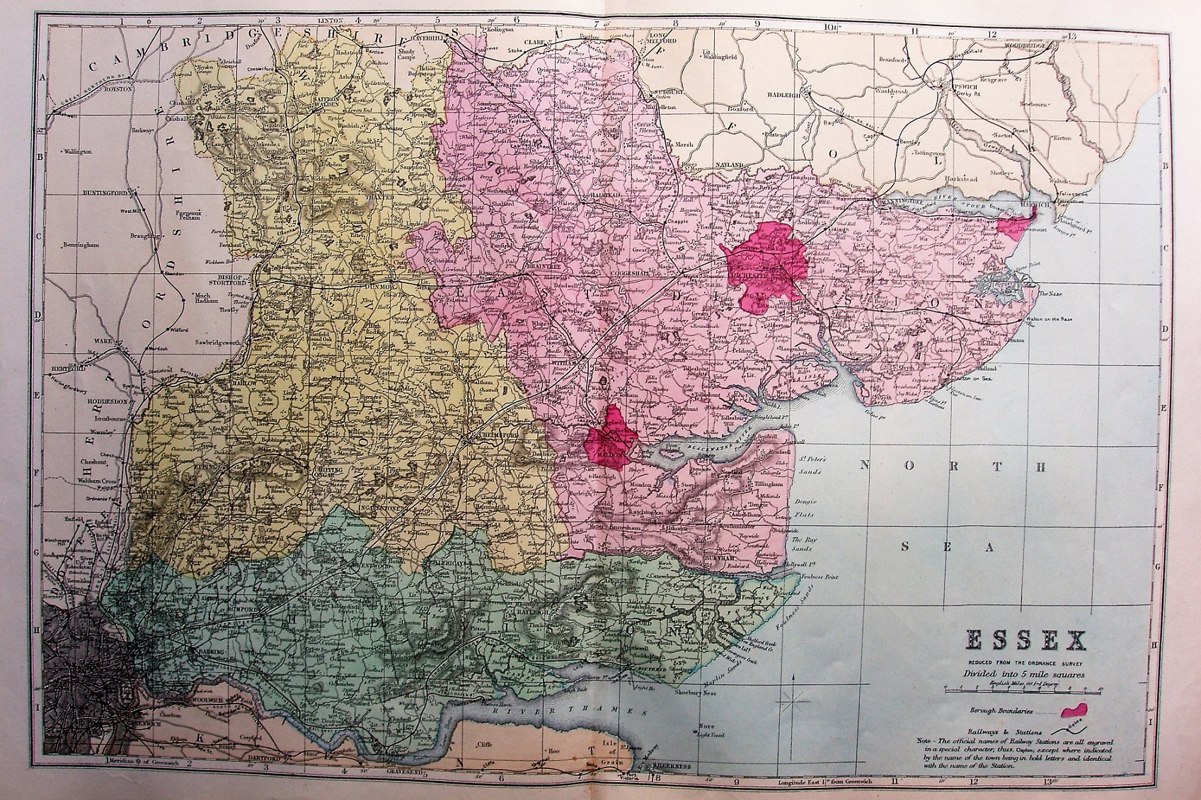
The most prominent feature are the bright coloured for the Parliamentary Divisions, as used 1868 to 1885. There is a page/sheet number 16 in the top right corner, but a long way from the map.
Scale correct at 10 miles = 62.7mm, or 4.0 miles/inch, ie 1:255,000.
The railway from Southend to Shoeburyness is not shown (opened 1884), there are no sets of parallel lines to show "planned" lines (and there is no mention of planned lines in the key); compare this state to the 1884 map which follows.