Jefferys's Itinerary: or, Travellers Companion, through England, Wales & Part of Scotland
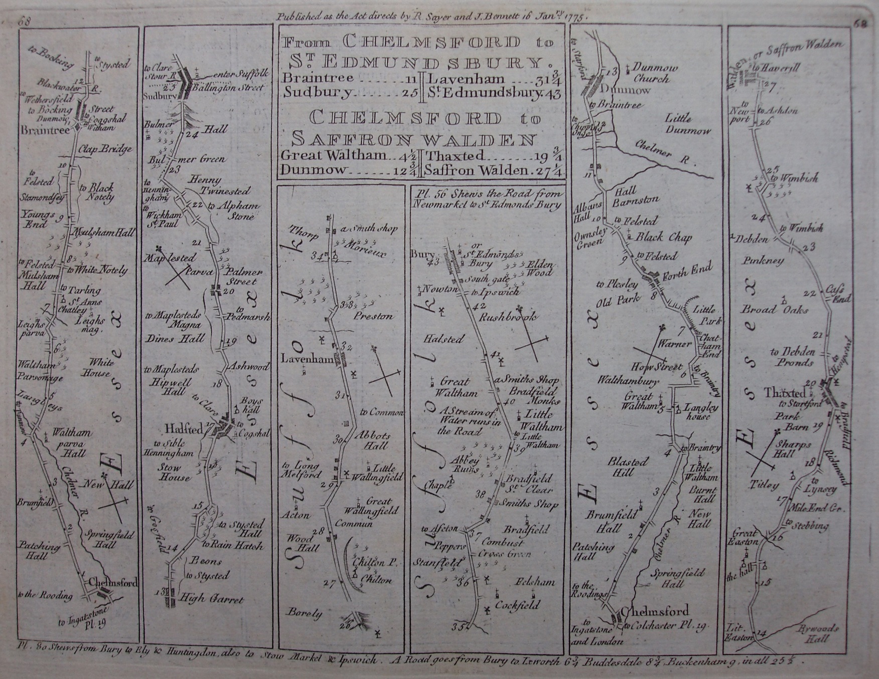
More maps based on Senex 1719, but this time they have been copied from a French version in 1759, with a translation back to English and some changes to the maps. The strips are all thinner (& a little taller), but there are very few differences in the roads, houses and towns (Chelmsford has lost its church). The maps are printed double sided and have retained their page numbers top left and top right - the above is now plate 68 (with plate 67 on its reverse; cf Senex 1757).
There are now more notes about where other roads from the towns on the current map are also to be found on other maps, plus distances. At the head of the plate is also "Published as the Act directs by R Sayer and J Bennett 16 Janry 1775."
Scale of about 7 miles = 80mm, ie about 2.22 miles to an inch (instead of Ogilby's 1 mile to an inch), or 1:140,000.