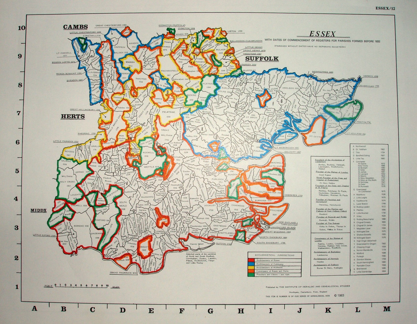
Essex
Coloured map of parishes showing Ecclesiastical Jurisdictions.
Someone seems to have thought adding an alphanumeric grid (done manually to the 1980 one) was a good idea - so here it is printed. Lot smaller though.
Displayed scale of 10 miles = 31.5mm, or 8.1 miles/inch; actual scale = 7.7 miles/inch, or 1:490,000.
The only markings are for Parishes boundaries, their names, and dates of first parish registers. (Different colours from the 1980 one too.)