The Up to Date Road Map of Essex
Two covers containing the same map, with different prices:
- Smooth pale wrap-around paper cover, taller than the other one, priced at 7 1/2d Net.
- Rough paper pale brown wrap-around cover, shorter than the other one, priced at 9d Net
In both cases no mention of a cloth version, and no adverts either inside the front cover or on the back cover.
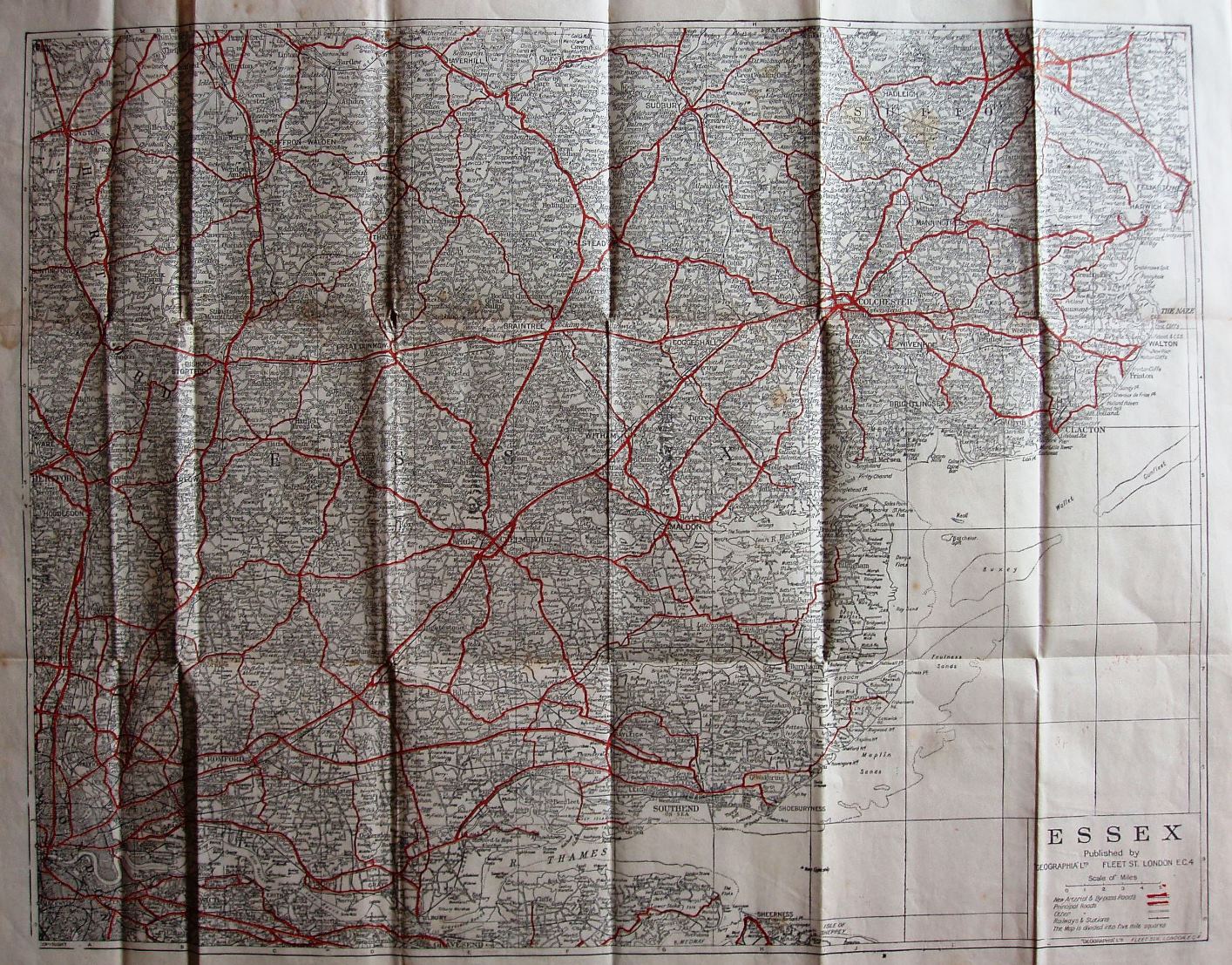
No railway line to Allhallows (Kent) shown (opened 1932), but Geographia were slow to show new lines.
Scale correct at 5 miles = 43mm, or 3.0 miles/inch, ie 1:185,000.
Arterial and bypass roads are in thick red (still unnumbered), and (other) Principal roads in thin red. The Southend Arterial (opened 1925) and the Stanford-le-Hope bypass (c.1932) are present, plus the Chelmsford bypass shown as open 1931).
The map is published by Geographia Ltd, 167 Fleet Street on the cover, but no number on the map. Perhaps the 7 1/2d one is 1942 given the change of address (from c.1942 and the absence of a number on the map itself) and the 9D one a couple of years later (but pre end of the war as no code).
This is the same map as that used in Geographia's "Cycling" maps. More details on Geographia's maps are on the Publisher's page.