Letts Popular Maps (albeit now published by Mason & Payne)
It's the J&C Walker/Letts map, but now without the 1884 earthquakes and in with the large raft of constituency changes that arrived in 1885, ie as will appear in 1887 (next map).
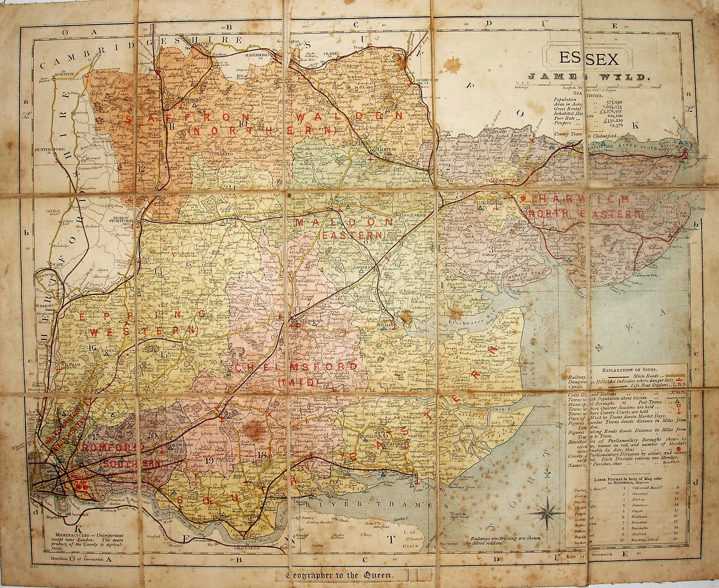
Hundreds referenced to a table, but uncoloured (and not edge-coloured), with only Colchester Borough shown as a different colour from the surrounding Division. No list of Polling Place, but the nine Divisions (West Ham being shown as a single Division with 2 MPs) are colour washed (not edge-coloured), with names overprinted on the map. Major roads have a thicker line on one side; all roads uncoloured.
Scale correct at 5 miles = 32.3mm, or 3.9 miles/inch, ie 1:245,000 (the same as the 1884 Letts map, ie a little larger than the engaved maps).
There is a red line over a double (?) black line from Barking to Upminster, but then onwards to Pitsea there is a dashed red line (opened 1885 and 1886/88 respectively, but all authorised 1882), but the line to Shoeburyness (also authorised 1882, and opened 1884) is not even shown as planned.
Beneath the cartouche is a stuck on label "James Wyld", and across the base there is a stuck on label "Geographer to the Queen". Letts had gone bankrupt and the maps were taken over and published by Mason & Payne.
The map is dissected and mounted on cloth, folded in the same way as the "Walkers' Essex" maps are; there are adverts for Wyld's cycling and other maps stuck to the back cover, but a front cover/folding cover is missing.
Many J&C Walker maps are shown on the Walker's Map Publisher page.