Through Guide Series: Eastern Counties (1st edition)
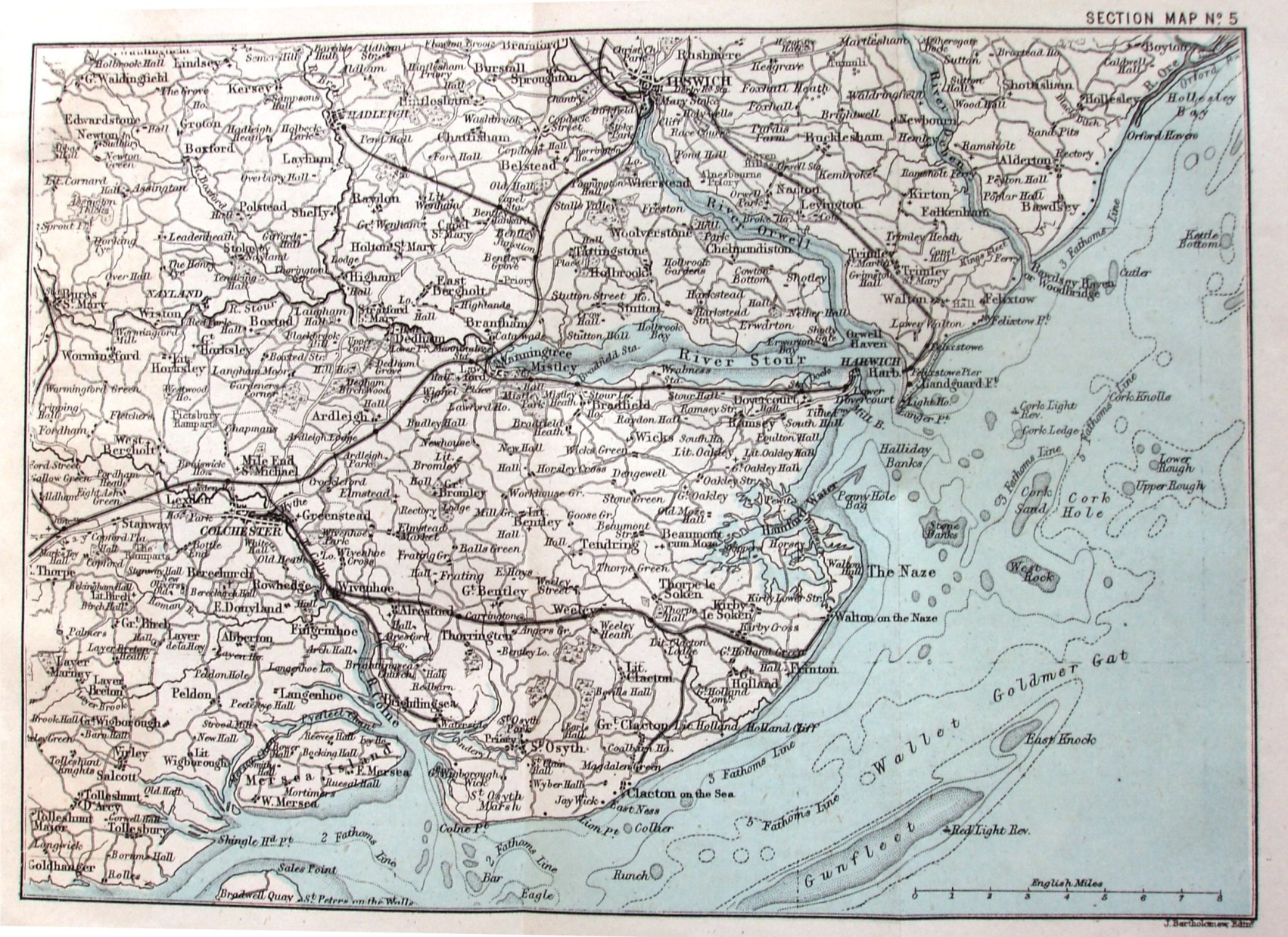
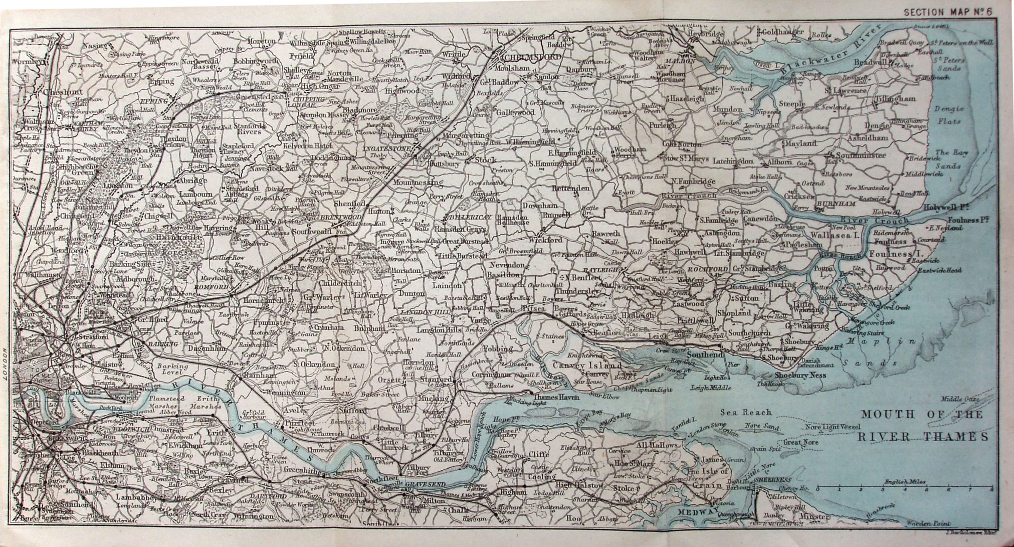
Fold out Section Map No 5 and No 6, covering north-east Essex and south Suffolk, and Thames Estuary respectively. No 5 has line to Clacton (opened 1882). No 6 has line to Southend, but not to Shoeburyness (opened 1884) or Barking to Upminster (1885).
Scale 8 miles = 50mm, or 4.1 miles/inch, ie 1:255,000.
The maps were provided by Bartholomews. There was a 3rd edition in 1892.