Cruchley's County Maps of England, for Cyclists, Tourists, &c. Essex
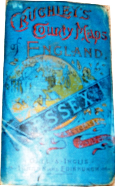
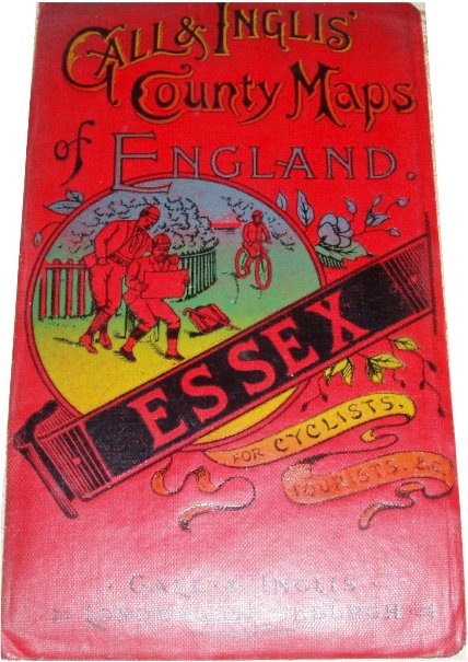
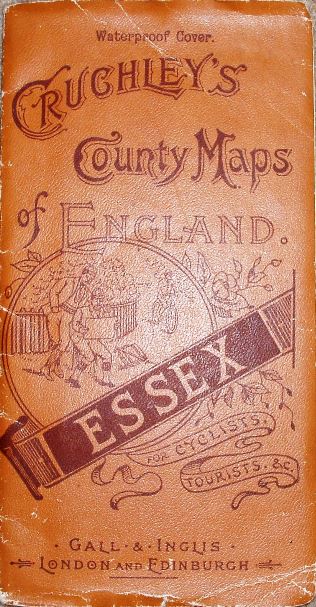
All three maps have covers where two men in front of a fence consult a map whilst a cyclist approaches; the differences are:
1. Blue, short cover (153 x 91mm) - Cruchley's map - no code - paper on cloth
2. Red, short cover (153 x 91mm) - Gall & Inglis' map - Code A3x - paper on cloth - panel regarding elevation
3. Dun, tall cover (178 x 93mm) - Cruchley's map - Code A3x - paper - panel regarding elevation.
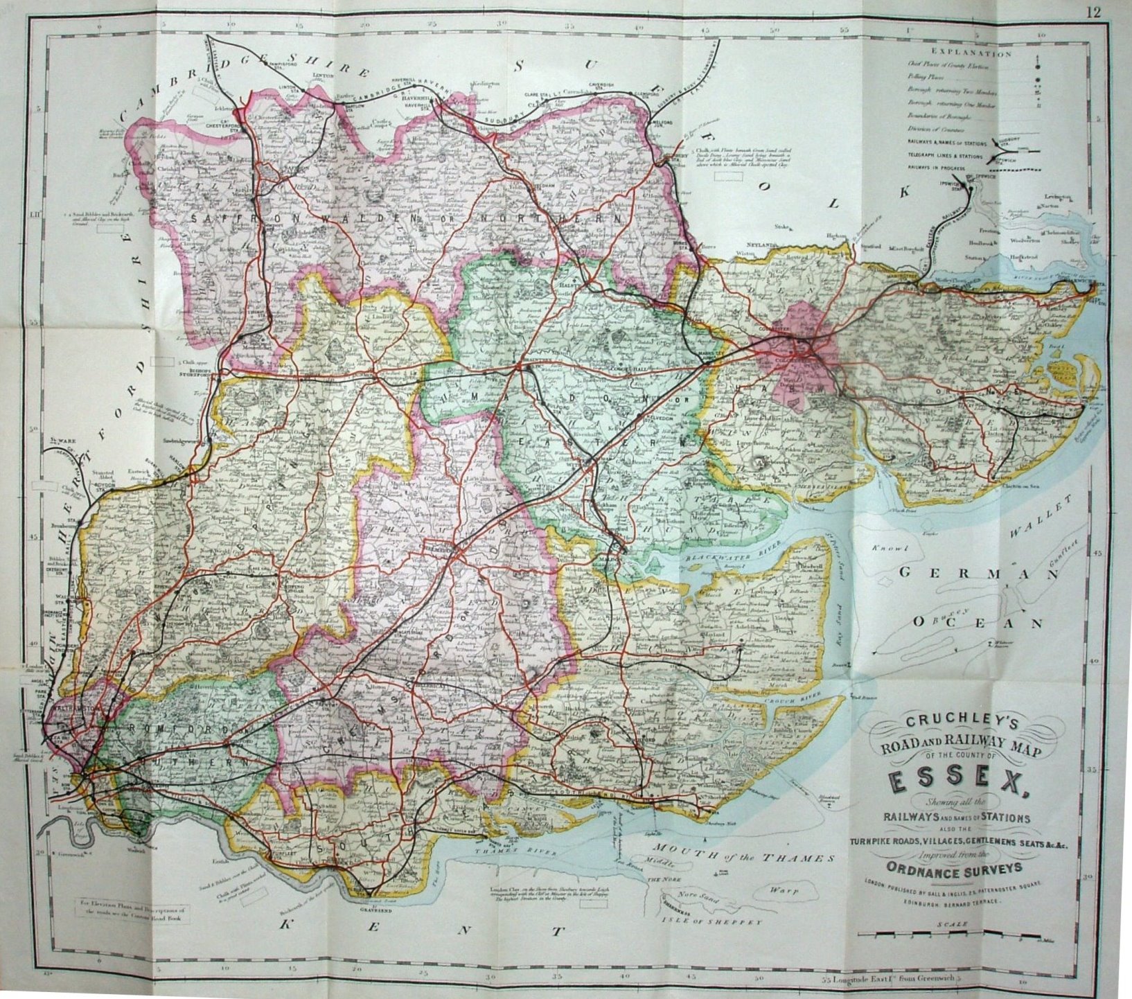
The 2nd & 3rd copies have a panel in the lower left that states "For Elevation Plans and Descriptions of the roads, see the "Contour" Road Book." The North Sea is still labelled the "German Ocean", as that was on the original Cary maps; this is the last time we will see it.
Displayed scale of 10 miles = 94.5mm, or 2.7 miles/inch; actual scale = 2.8 miles/inch, or 1:175,000.
Gall & Inglis evidently felt the name of "Cruchley" was a major aid to sales - as the 1st & 3rd maps use his name on these 1895/96 covers (& on the face on all 3 maps), despite him selling his business to G&I in 1877 and dying in 1881.
More details on Cruchley's/G&I's maps are on the Publisher's page.
The title on the map has changed somewhat since the 1886 map - from being "Cruchley's County Map of Essex, Showing ..." to "Cruchley's Road and Railway Map of the County of Essex, Showing ...". The engraving of the scale bar has also been changed, but not much else, apart from the railways.
On the railways there is Forest Gate to Tottenham (opened 1894), but not the Corringham light (opened 1901) - although later Cruchley/Gall & Inglis maps don't show this either. This leaves the dating very approximate.