New Large Scale Ordnance Atlas of the British Isles
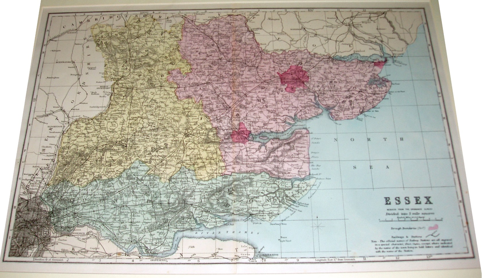
The most prominent feature are the bright coloured for the Parliamentary Divisions, as used 1868 to 1885. There is a page/sheet number 16 in the top right corner, but a long way from the map.
More details on Bacon's maps are on the Publisher's page.
Scale correct at 10 miles = 62.7mm, or 4.0 miles/inch, ie 1:255,000.
The railway from Southend to Shoeburyness is the latest shown as a solid line (opened 1884), but there are also many later railways shown by parallel lines which presumably means "planned", eg Barking to Upminster (opened 1885), Upminster to Laindon and on to Pitsea (opened 1886 & 1888), and Grays Thurrock to Upminster (opened 1892) plus Upminster to Romford (opened 1893); the parallel lines are not explained in the key (as in 1883).