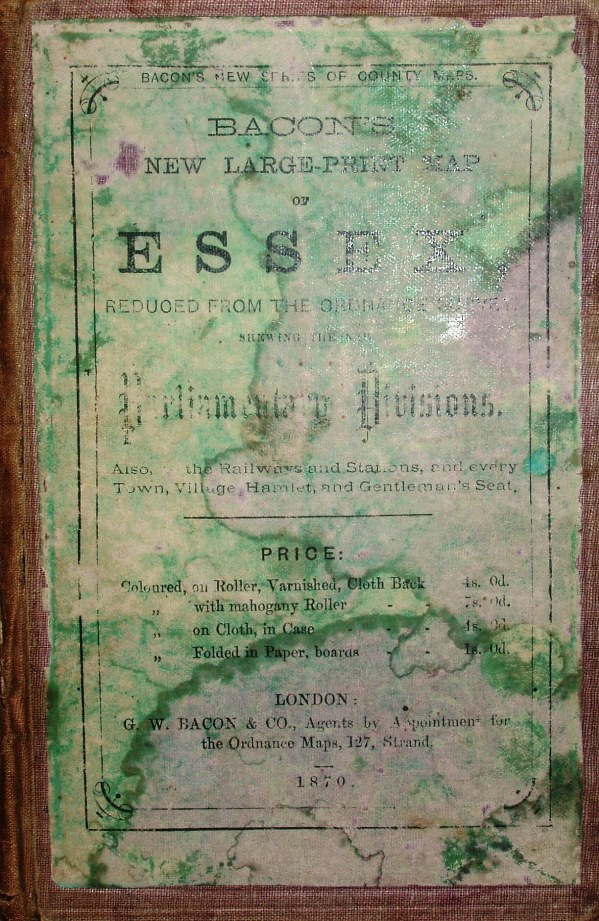
New Large Print Map of Essex
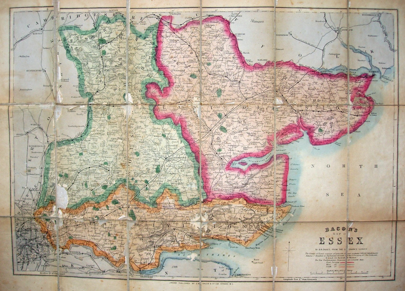
The three Divisions of Essex (introduced 1868) shown coloured with heavy edge-colouring. The map - "by BR Davies, from the Ordnance Survey" - was used for Bacon's Map of [county] as here, for Bacon's New Tourist Map of [county], in Bacon's County Atlas and in Bacon's Large Print County Atlas, and for Bacon's New Large Print map of [county] - all starting in 1869/1870.
Displayed scale of 6 miles = 53mm, or 2.9 miles/inch; actual scale = 2.7 miles/inch, or 1:175,000.
It's not cheap, as the front cover gives the prices as being 4s. for Coloured on Cloth, in Case (as is this copy), or 1s. for Coloured on Paper, folded in Boards. Other options are 4s. for Coloured on Roller, varnished on cloth back, or 7s. to have a mahogony roller.
The Walthamstow branch line is present (opened 1870), but the Chingford line is only planned (opened 1873). The county's population is stated, but using the 1851 census figure. Card cover is dated 1870.
More details on Bacon's maps are on the Publisher's page.