British Atlas
The Atlas was first published in 1837 (Essex is dated 1835), and then several times to 1871 (or later), as Hobson's Fox Hunting Atlas (1850 to 1880), as Walker's Fox Hunting Atlas (up to 1895) and as Lett's Popular Atlas (1884 & 87). The maps were also published separately, dissected on cloth and folded up between boards.
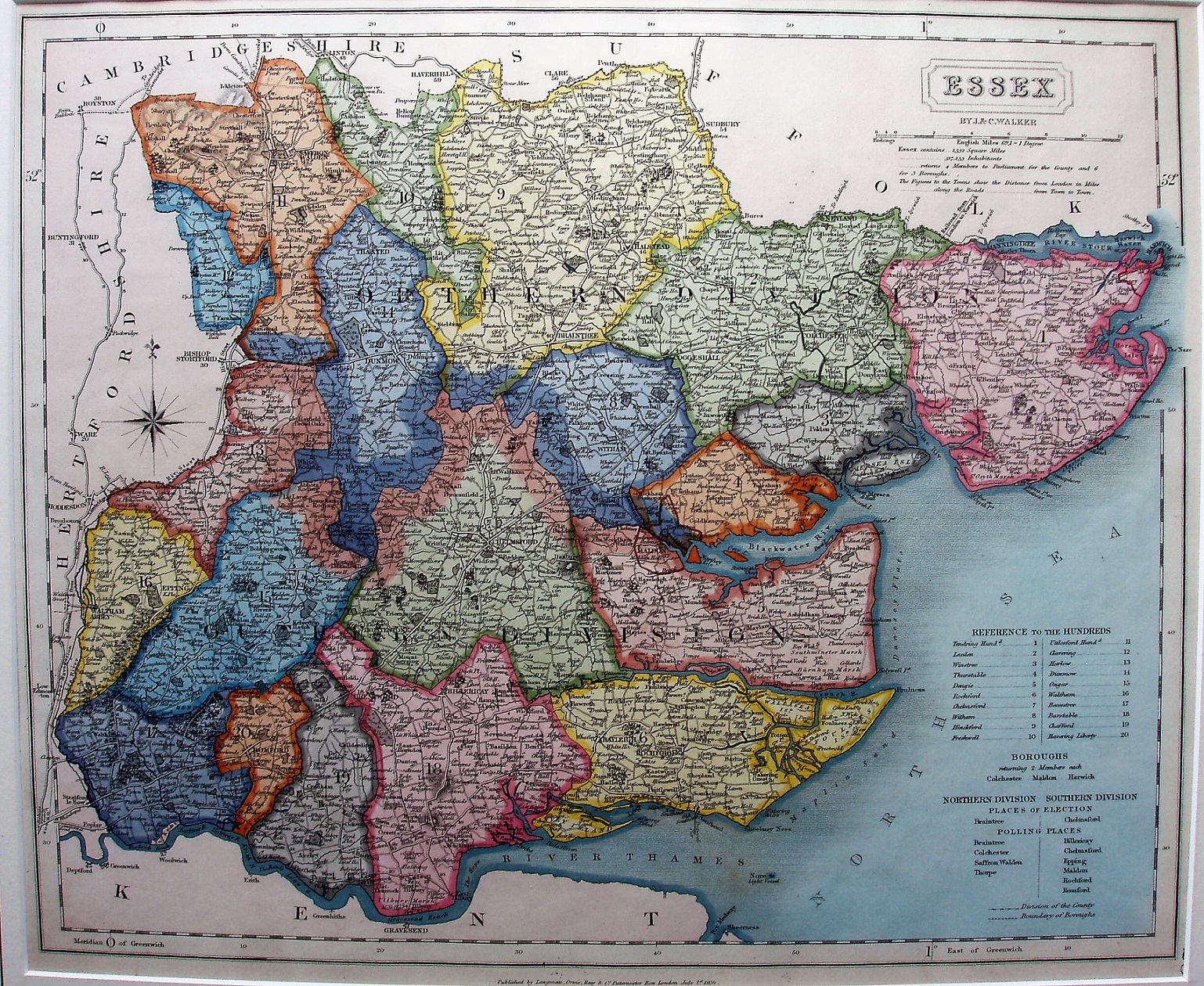
Hundreds are referenced to a table, plus listing parliamentary boroughs, places of election and polling places. Hundreds have broad edge-colouring and are excessively colour washed, with Harwich & Maldon Boroughs red-lined and Colchester dark green lined. Four Polling Places in North, 6 in the South. Divisions very thickly edge-coloured. Major roads have a thicker line on one side; all roads uncoloured.
Scale correct at 1+12 miles = 83mm, or 3.9 miles/inch, ie 1:250,000.
Railways are shown as faint pecked black lines - Bishops Gate St to Colchester (authorised 1836, opened 1843) and into Suffolk (not opened until 1846) "Railroad from London to Norwich", and from close to Bishops Gate St past Saffron Walden and into Cambridgeshire (authorised 1835, opened 1845); there is also a faint pecked black line from Romford to Thames Haven Docks "Thames Haven Rail road" - which despite authorisation in 1836 was never built.
As it does not show railways that were authorised after 1839, I surmise this map was created in 1839. The only part that was actually open by 1839 was Mile End to Romford (see railways page).
Under the cartouche is "By J & C Walker", but along the bottom is "Published by Longman, Orme, Rees & Co, Paternoster Row, London, July 1st 1839".
Many J&C Walker maps are shown on the Walker's Map Publisher page.