British Atlas
The Atlas was first published in 1837 (Essex is dated 1835), and then several times to 1871 (or later), as Hobson's Fox Hunting Atlas (1850 to 1880), as Walker's Fox Hunting Atlas (up to 1895) and as Lett's Popular Atlas (1884 & 87). The maps were also published separately, dissected on cloth and folded up between boards.
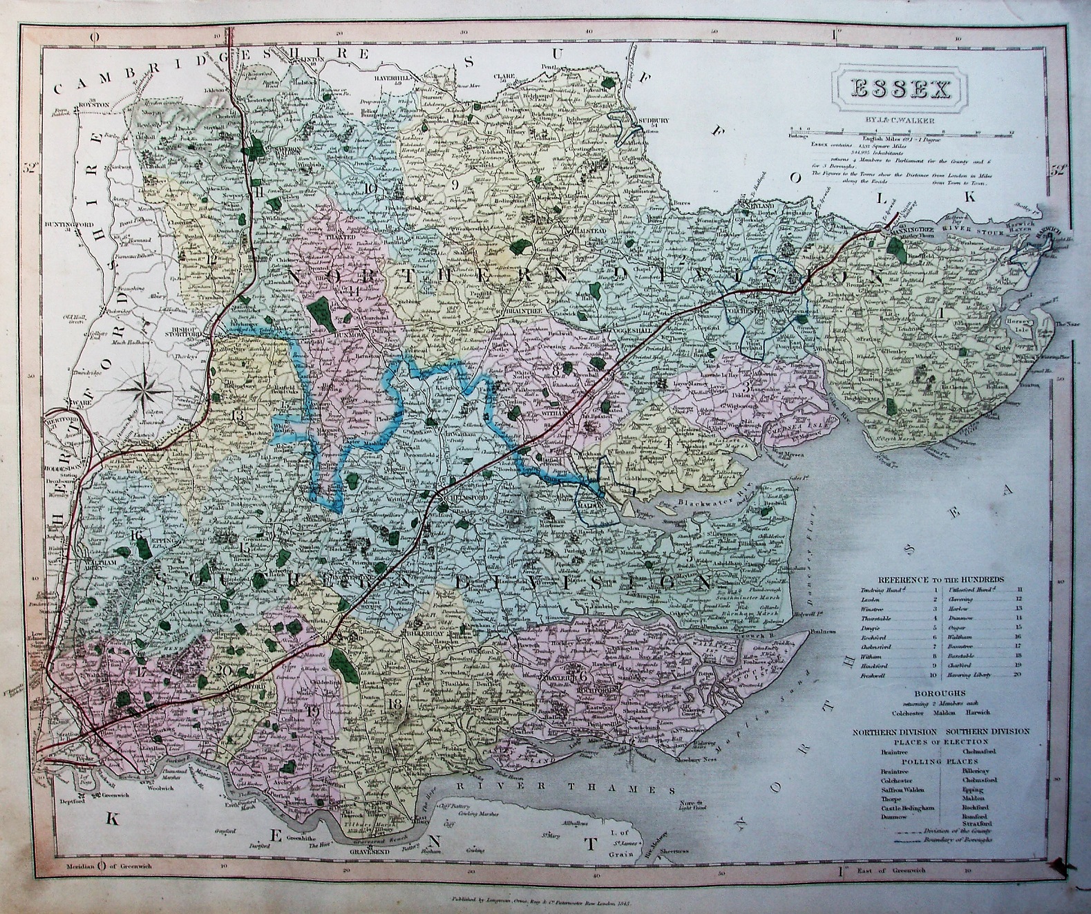
Hundreds referenced to a table, plus listing parliamentary boroughs, places of election and polling places. Hundreds colour washed (but not edge-coloured), with Colchester, Harwich & Maldon Boroughs all blue-lined. Six Polling Places in North, 7 in the South. Divisions thickly edge-coloured. Major roads have a thicker line on one side; all roads uncoloured.
Scale correct at 12 miles = 82mm, or 4.0 miles/inch, ie 1:255,000.
Railways black "quad line" now runs from Bishops Stortford past Gt Chesterford into Cambs (authorised 1836; opened 1845) - "Northern & Eastern Railway" - and from Colchester into Suffolk (1844; 1846) - "East Union Railway"; both have red line added to their full length. There is a dark red line (no underlying black lines) from West Ham to Woolwich Reach (authorised 1844; opened 1846), using the wrong route, and the route to Hertford (1841; 1843) now has a "Quad line" under the red. The faint pecked black line from Romford to Thames Haven Docks has no red overlay.
"By J & C Walker", but along bottom "Published by Longman, Orme, Rees & Co, Paternoster Row, London, 1845." From the red lines, I estimate its selling date as being c.1846.
Many J&C Walker maps are shown on the Walker's Map Publisher page.