British Atlas
The Atlas was first published in 1837 (Essex is dated 1835), and then several times to 1871 (or later), as Hobson's Fox Hunting Atlas (1850 to 1880), as Walker's Fox Hunting Atlas (up to 1895) and as Lett's Popular Atlas (1884 & 87). This example is an 1835 map dissected on cloth and sold folded up between boards, with later annotations.
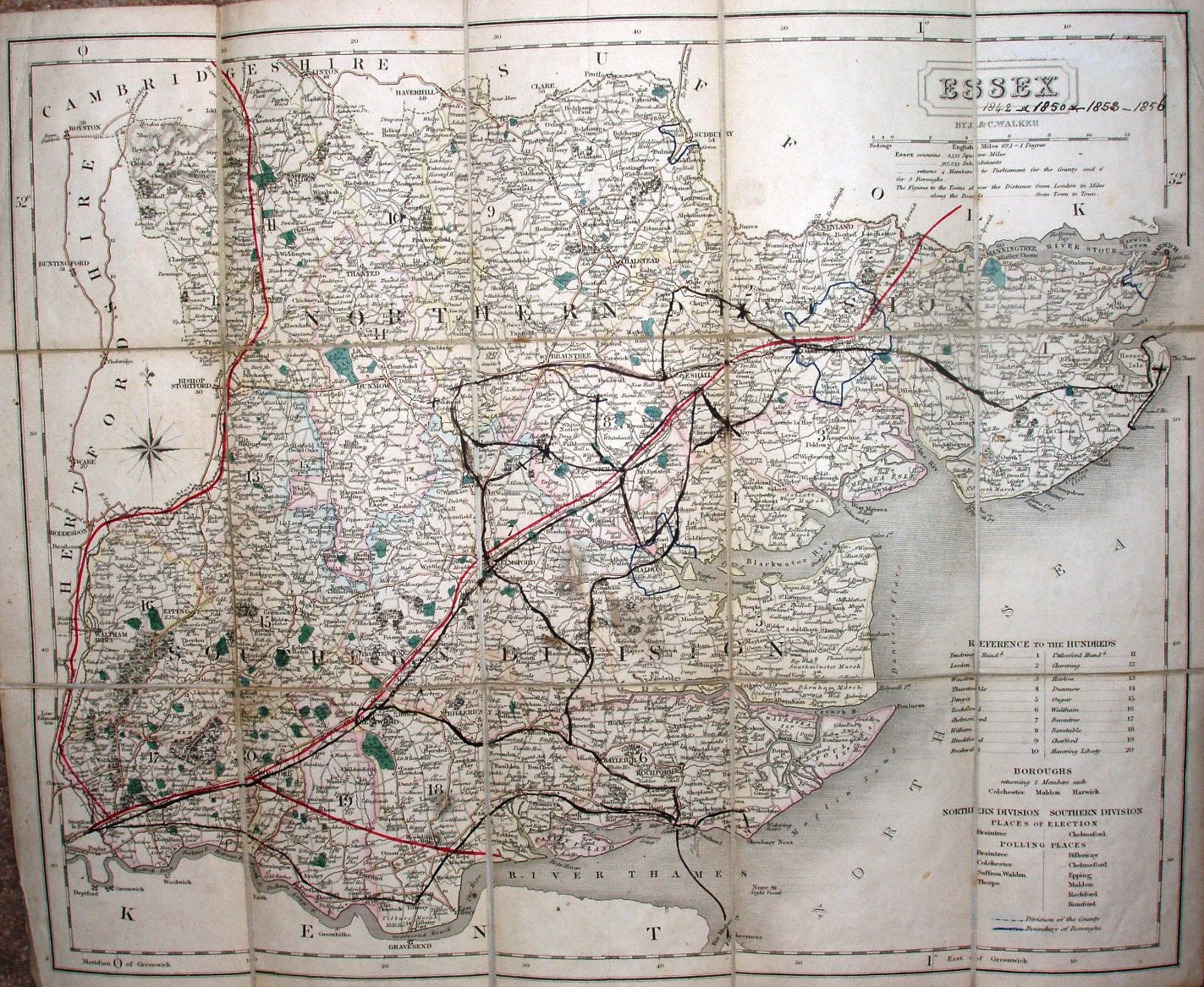
Hundreds are referenced to a table, plus listings of parliamentary boroughs, places of election and polling places. Hundreds are (palely) edge-coloured; Borough boundaries for Colchester, Harwich and Maldon are shown in blue. Four Polling Places are named in North, and six in the South; the two Divisions are not edge-coloured, but have a faint dashed line. Major roads have a thicker line on one side, and are coloured pale brown.
Under the cartouche is "By J & C Walker", but along the bottom is "Published by Longman, Orme, Rees & Co, Paternoster Row, London, July 1st 1835".
Scale correct at 1+12 miles = 83.5mm, or 3.9 miles/inch, ie 1:250,000.
The map was printed with no black lines at all for railways, and then for sale bright red lines have been added, but without even a faint pecked black line underneath - from Stratford past Colchester (authorised 1836; opened 1846) and into Suffolk, and from West Ham past Saffron Walden and into Cambridgeshire (1835; 1845); also from Romford to Thames Haven Docks (that was authorised but never built). None are named.
Someone has added black lines for railways in 1850, 1858 and 1856 (sic), and later (eg in 1889) , plus others that never happened. From the red lines, this copy was sold in about 1836.
The road in London is labelled "From Whitechapel"; all later maps have just "Whitechapel". Bishops Gate St is not named; all later maps name this road. There is no road from Clapton down to Whitechapel Rd; all later maps have this addition. There is no church symbol in the latitude border at 51o 36' north; all later maps have this symbol. Thames Haven Docks are not named; they soon will be. These factors make this (underlying) map the earliest of them all.
Many J&C Walker maps are shown on the Walker's Map Publisher page.