British Atlas
The Atlas was first published in 1837 (Essex is dated 1835), and then several times to 1871 (or later), as Hobson's Fox Hunting Atlas (1850 to 1880), as Walker's Fox Hunting Atlas (up to 1895) and as Lett's Popular Atlas (1884 & 87). The maps were also published separately, dissected on cloth and folded up between boards.
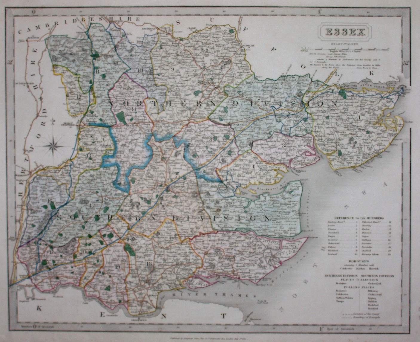
Hundreds are referenced to a table, and are edge-coloured and colour washed. Borough boundaries for Colchester, Harwich and Maldon are shown in blue. Four Polling Places are named in North, and six in the South; the two Divisions are thickly edge-coloured. Major roads have a thicker line on one side; the roads from London to Harwich and from West Ham to Great Chesterford are shown in blue (Post roads?), the latter continuing into Cambridgeshire towards Cambridge and towards Newmarket; other major roads are coloured pale brown.
Scale correct at 1+12 miles = 83.5mm, or 3.9 miles/inch, ie 1:250,000.
This copy is from a very early edition, with the very earliest railways shown by a hand drawn yellow line over a faint black pecked line. These are shown from Bishops Gate St to Colchester (authorised 1836, opened 1843) and into Suffolk (not opened until 1846) "Railroad from London to Norwich", and from close to Bishops Gate St past Saffron Walden and into Cambridgeshire (authorised 1835, opened 1845); there is also a faint black pecked line from Romford to the Thames Haven Docks (now named on the map) "Thames Haven Rail road" - which despite authorisation in 1836 was never built.
Under the cartouche is "By J & C Walker", but along the bottom is "Published by Longman, Orme, Rees & Co, Paternoster Row, London, July 1st 1835".
This example is an 1835 map, and judging by the railways shown was sold in around 1836.
Many J&C Walker maps are shown on the Walker's Map Publisher page.