A New Pocket Atlas and Geography of England & Wales
Appearance
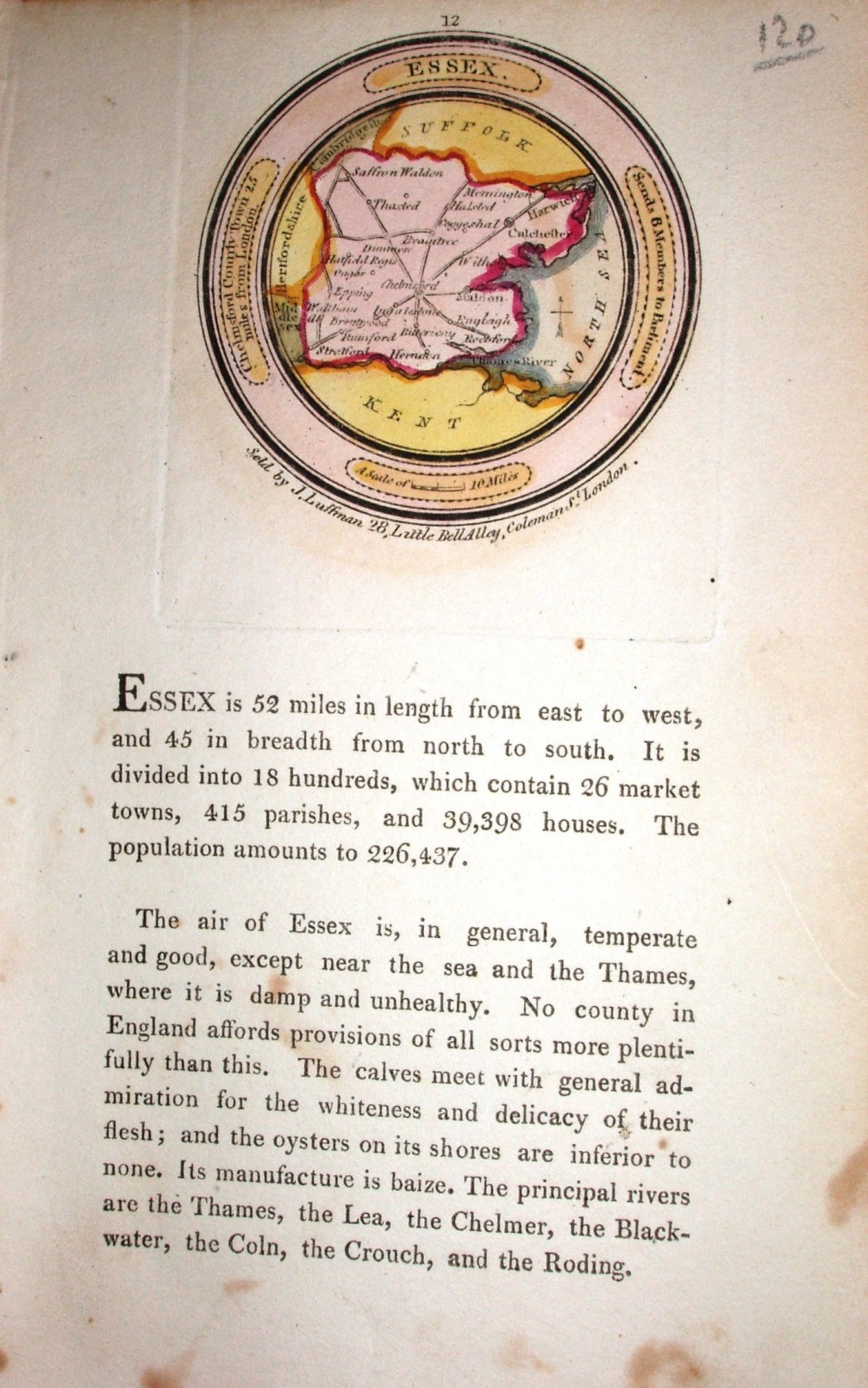
Luffman produced this atlas for children; it has a very simple map, which given its tiny scale results in very few details - and those only schematically. The county is colour washed, as are adjacent counties - which show no details apart from their borders with Essex and their names. Within Essex there are just 20 named towns plus lines joining them; there is neither height hatchuring nor patterning of forest/woods, nor any rivers.
Each map is followed by some notes on statistics of the county (number of houses etc) and on the climate and dairy and arable produce.
Title & other inscriptions
Top centre: 12 (plate number), 10mm above border initially, and then about 1mm above.
Bottom centre below border: "Sold by J Luffman 28, Little Bell Alley, Coleman St, London."
Top centre within border: "Essex".
Bottom centre within border: "A Scale of 10 Miles" - shown as a curved line (so almost useless, other than as a general guide).
Centre left within border: "Chelmsford County Town, 25 Miles for London".
Centre right within border: "Sends 6 Members to Parliament".
No latitude or longitude, or names of drawer or engraver. Very simple compass in (named) North Sea.
Personnel
John Luffman (1751-1821) was an engraver, cartographer, printer, author, publisher and bookseller - but principally an engraver. He produced several maps from 1776 onwards of parts of the UK, the Caribbean, Italy, European coasts, and although he was bankrupt for a time around 1793 he produced A New Pocket Atlas and Geography of England & Wales in 1801. He had many addresses in London, including Coleman Street 1800-1806. WB
The Atlas
A New Pocket Atlas and Geography of England and Wales, Illustrated with Fifty-five Copper plates. London. Printed for Lackington, Allen and Co. Temple of the Muses Finsbury Square. 1806. CUL: Atlas 7.80.3
There is little to say about this atlas, other than it seems to have only lasted 3 years. Even if aimed at children it seems to be a very simplistic map. Given its tiny size (only Perrot 1823 is smaller) and comparative rarity, this is perhaps the most expensive Essex map of all - per square mm of printing.
Editions
1803 - maps in his New Pocket Atlas, with plate numbers about 10mm above the circular border. LC SK NF LD BB CQ WH HH KB DB
1803 - the New Pocket Atlas reissued, with plate numbers moved to about 1mm above the circular border; no other changes at all. LC SK NF LD BB CQ HH KB DB
1805 - Deadman's cartobibliographies state there was another Luffman issue, with the map's imprint changed to "Published by J Luffman ..." LD RD (instead of "Sold by ...").
1806 - the New Pocket Atlas reissued by Lackington, Allen and Co - identical to Luffman's 1st 1803 map above (ie the plate number well above from the border) LC KB
1806 - the New Pocket Atlas reissued by Lackington, Allen and Co - identical to Luffman's 2nd 1803 map above (ie the plate number just above the border). LC SK NF LD BB WH HH KB DB
1806 - the New Pocket Atlas reissued by Lackington Allen and Co with no plate number at all NF CQ DB - perhaps the same as Lackington's 1st 1806 map above, but a trimmed page that has lost its plate number?