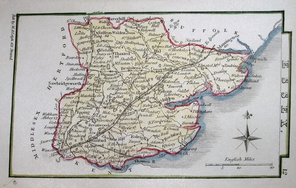
Leigh's New Atlas of England & Wales
This could be from the New Atlas or from the New Pocket Atlas work - it is the same map. See Hall's Map Publisher page. There is a "12" in the top right corner alongside Essex - if you hold the map up in portrait fashion, which is how it was in the atlases. Major places have distances from London noted against them on the map, but they look pretty approximate (all unchanged from earlier copies).
Across the base is: Pub by M.A. Leigh, 421 Strand - ie Sidney Hall has been erased. After about 1839 the busiess was named Leigh & Son.
This copy is from about 1837, with a planned railway past Chelmsford and Colchester (and to Thames Haven - both lines authorised in 1836); the lines are very smooth, but the other early railway towards Cambridge - authorised 1835 - is not shown.
Displayed scale of 20 miles = 29mm, or 17.5 miles/inch; actual scale = 17.1 miles/inch, or 1:1,080,000.