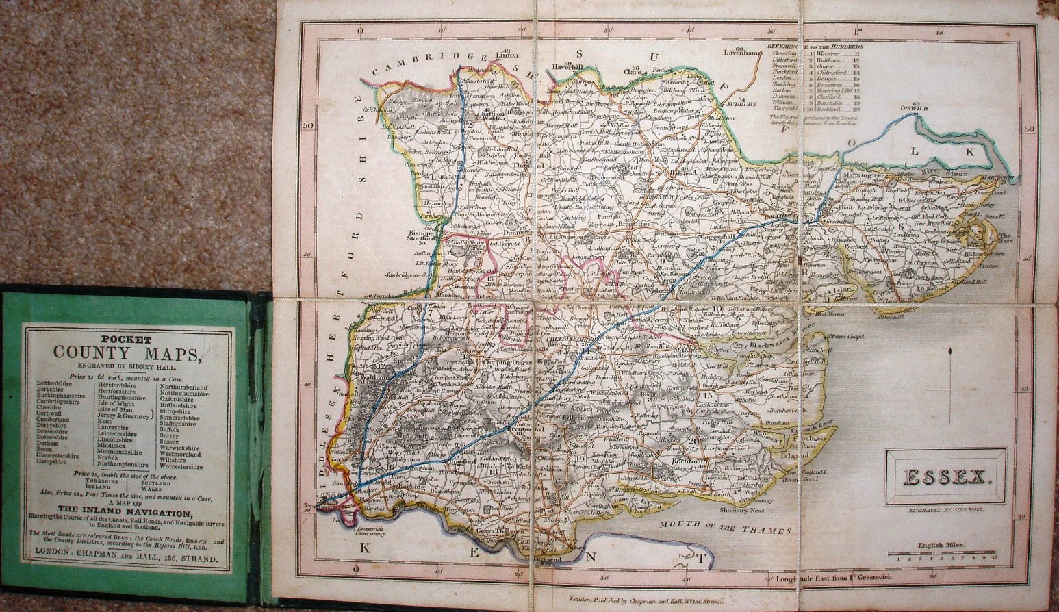
Essex
This individual county map is dissected on cloth and folded between boards (plain green, with just "Essex" on the front), and uses an 1833 map - the same underlying map as used in the Topographical Dictionary, A New British Atlas, A Travelling County Atlas and A New County Atlas. See Hall's Map Publisher page.
There is a table of Hundreds, with their numbers printed on the map; in this case the individual Hundreds are not coloured, but Turnpikes are shown in blue and other major roads in brown. The title appears in a rectangular cartouche, with underneath it Engraved by Sidy Hall.
Latitude and longitude (noted as being from Greewich) are inscribed around the border, with 2 minute bars and numbers every 10 minutes. Obviously there are no railways at this date, but there is a red line separating the Northern and Southern Divisions (unnamed) that had been introduced in 1832.
Across the bottom is "London. Published by Chapman and Hall, No 186 Strand."
Displayed scale of 10 miles = 37mm, or 6.9 miles/inch; actual scale = 6.7 miles/inch, or 1:420,000.