Excursions through Essex, Volume 1
The publication was in two volumes, described on the title page as follows:
"Excursions in the County of Essex; Comprising a brief Historical and Topographical Delineation of every Town and Village; together with Descriptions of the Residences of the Nobility and Gentry, Remains of Antiquity, and every other interesting obect of curiosity, forming A Complete Guide for the Traveller and Tourist. Illustrated with one hundred engravings, including a map of the County. ... London: Printed for Longman, Hurst, Rees, Orme, and Brown; J Greig, Upper-Street, Islington; and P Youngman, Witham, and Maldon, Essex. 1818."
It was written by a Thomas Cromwell, died 1820, although his name does not appear.
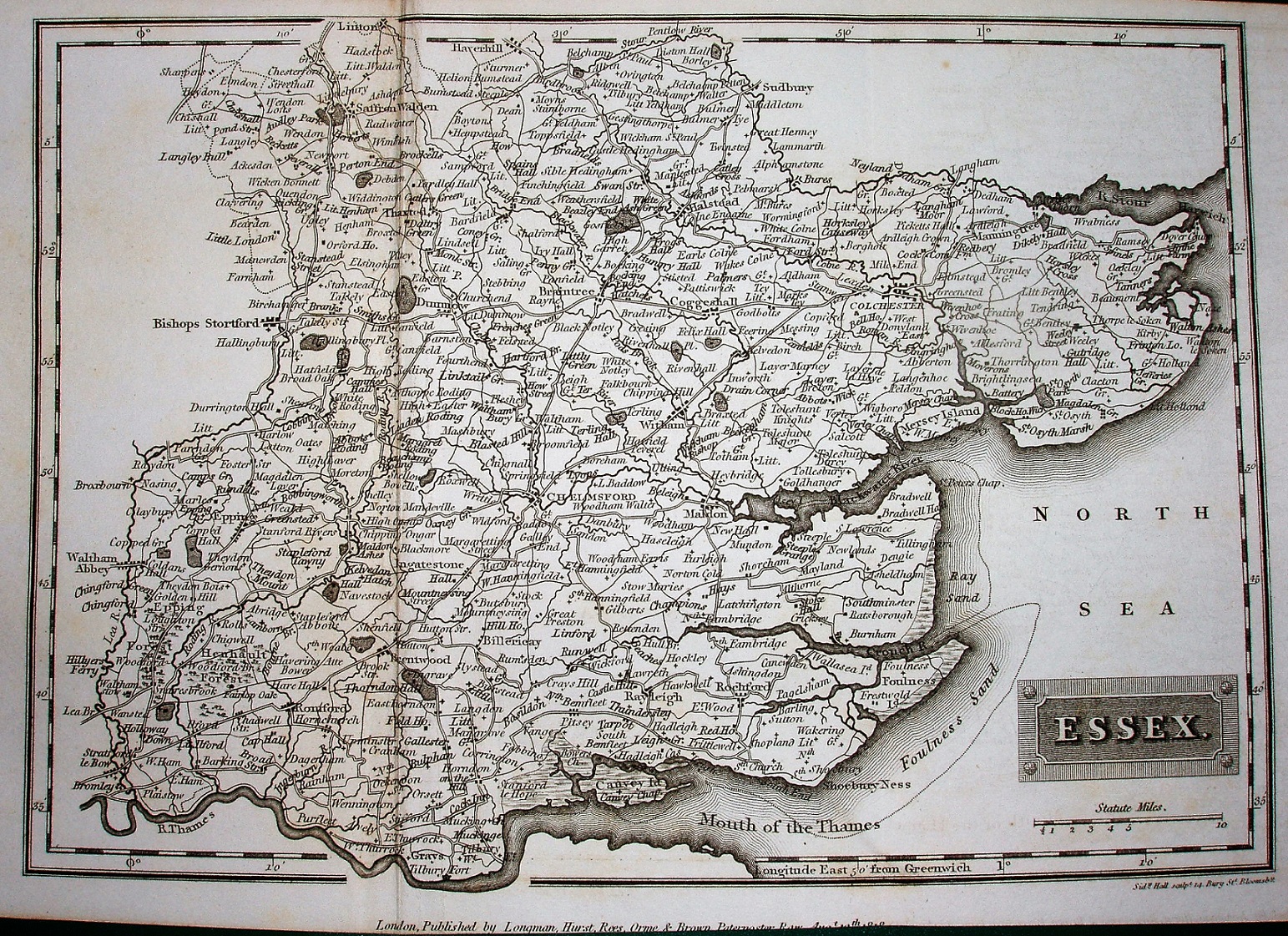
This map was the first of three maps that Sidney Hall would engrave of Essex. See Hall's Map Publisher page. Latitude and longitude (noted as being from Greewich) are inscribed around the border, with 2 minute bars and numbers every 10 minutes. Obviously there are no railways at this date, and this copy is completely uncoloured.
Across the bottom there is: "London, Published by Longman, Hurst, Rees, Orme and Brown, Paternoster Row, Augt 10th 1818." Below the right hand corner of the border there is: "Sidy Hall sulpt 14 Bury Stt Bloomsby."
Displayed scale of 10 miles = 32.5mm, or 7.8miles/inch; actual scale = 7.6 miles/inch, or 1:485,000.