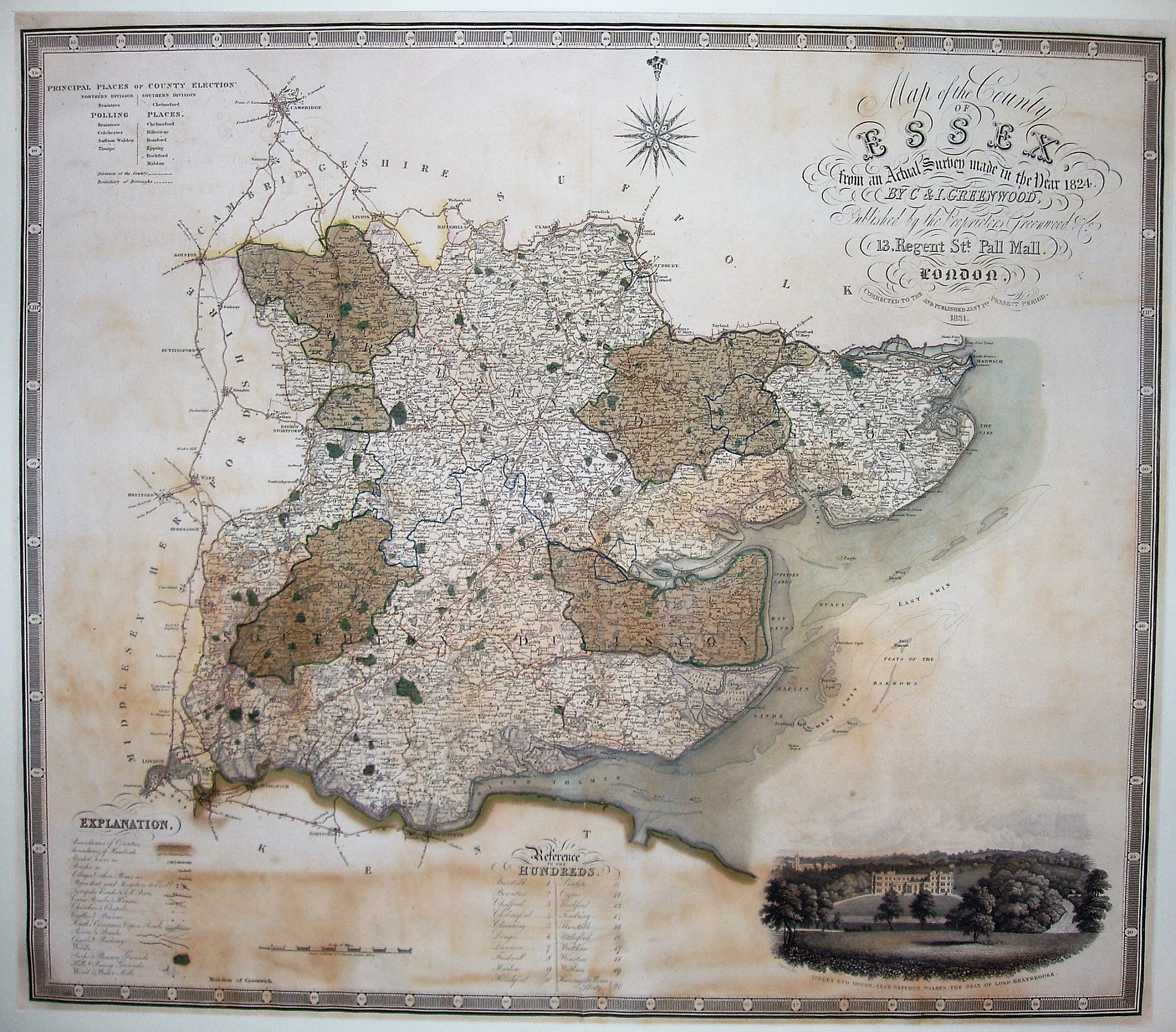
Atlas of the Counties of England
A reduced scale copy of the one inch Greenwood maps, published 1817 to 1833 (Essex being 1831), and the complete atlas in 1834.
Displayed scale of 10 miles = 80mm, or 3.2 miles/inch; actual scale 3.0 miles/inch, or 1:190,000.
The vignette is still of Audley End, but is a new engraving.