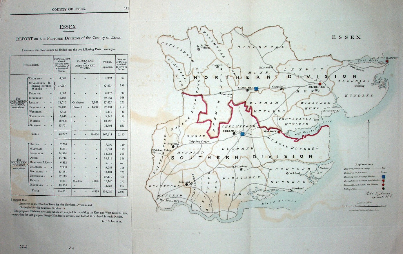
Essex
Lt Dawson was the official cartographer for the new Parliamentary Divisions and Parliamentary Boroughs following the 1832 Reform Act.
Displayed scale of 10 miles = 52mm, or 4.9 miles/inch; actual scale = 5.1 miles/inch, or 1:320,000.
There are few towns (and no villages) on the map, but there is a table of population per Hundred.