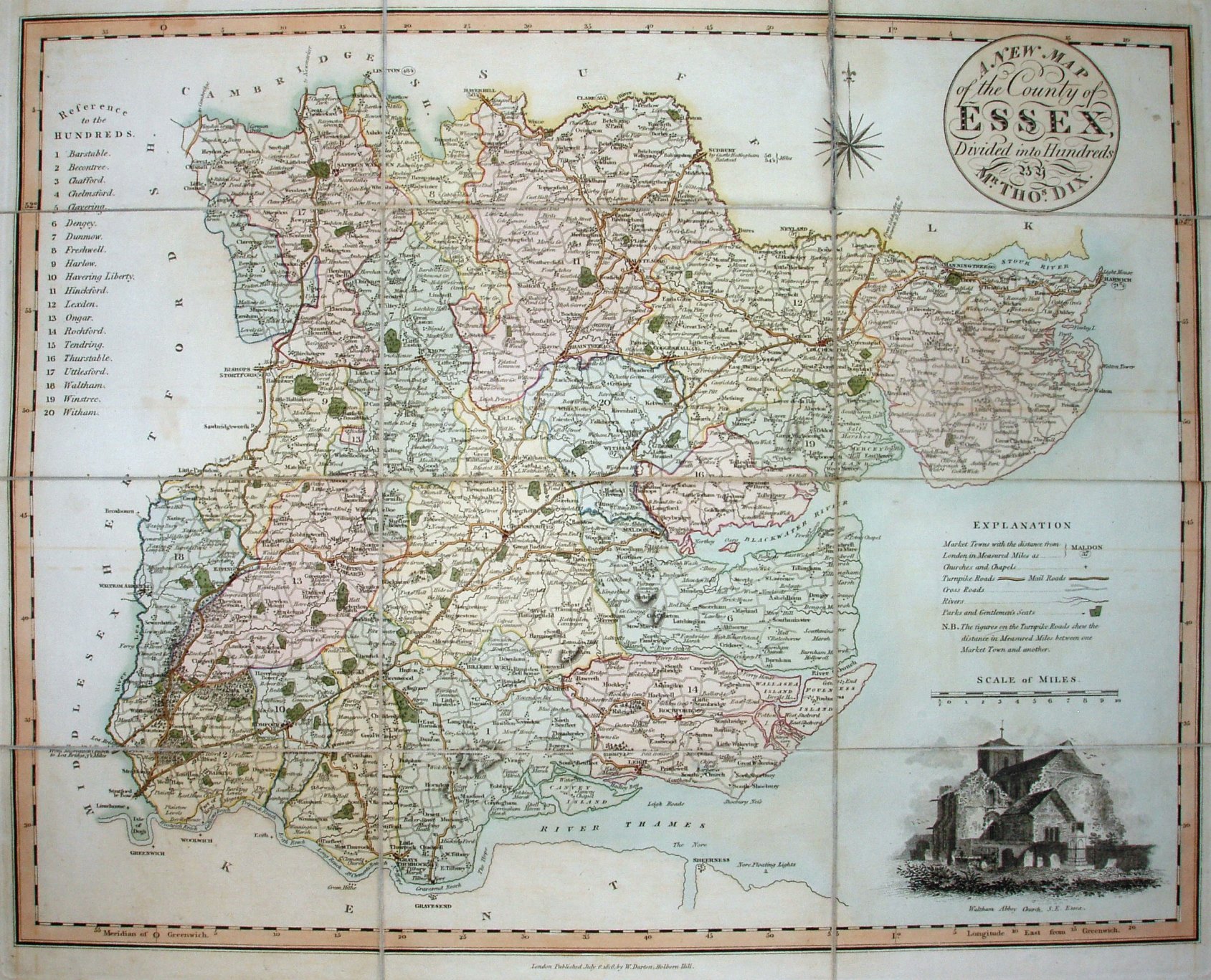
A New Map of the County of Essex
Slip case map, published before the A Complete Atlas of the English Counties in 1822. Vignette of Waltham Abbey in bottom right.
Scale correct at 1+10 miles = 72mm, or 3.85 miles/inch, ie 1:245,000.
The Atlas was published in 1822 with the date on the map unchanged, and then as The Counties of England in 1835, and again later in Post Office maps, railway and commercial maps, and for official county maps.