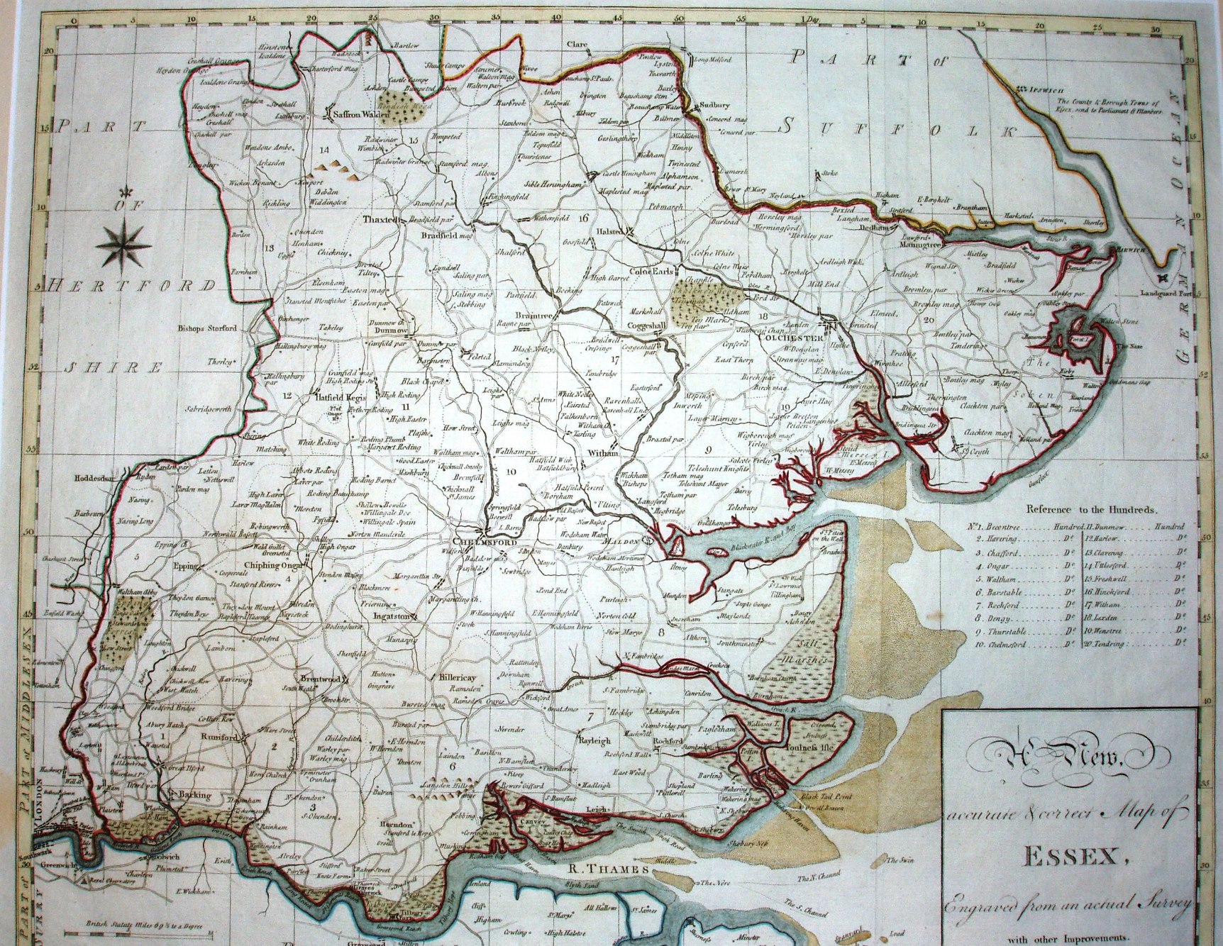
Essex
This map by Haywood is not from his atlas called Maps of the English Counties (which were copies of Bowen/Kitchin's Atlas Anglicanus), but rather a one-off map; it also has a different date from the atlas's map (April 5th 1787 on this map, Oct 1st 1787 in the atlas), and it is a little smaller than the atlas pages.
Everything else is the same, so this looks like a draft version. Note that the engraver's name on some maps is Haywood and on others it's Heywood.
Displayed scale of 10 miles = 53mm, or 4.8 miles/inch; actual scale = 3.8 miles/inch, or 1:240,000.