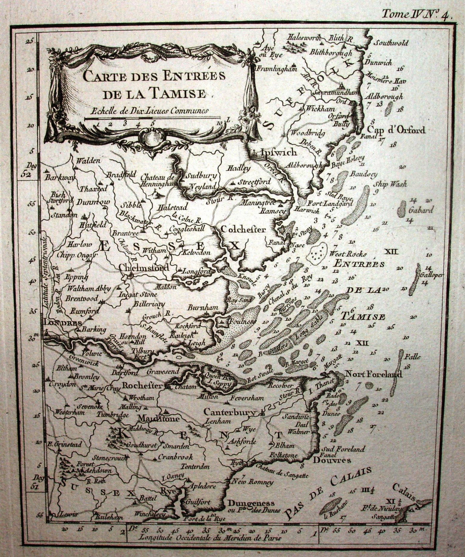
Carte des Entrees de la Tamise
A coastal map, but names towns as far inland as Saffron Walden.
It shows sandbanks and spot depths, but I doubt it was ever used for navigation.
Displayed scale of 10 "Lieues Communes" = 53.5mm, or 16.4 miles/inch; actual scale = 15.0 miles/inch, or 1:950,000. (Better scaling than on his 1759 map!)
Outside top right there is: Tome IV No 4.