This is a picture of a British Library copyright reprint - so don't copy it! Their prints are quite cheap if you'd like one; an original Saxton costs £3,500 (or more).
This is where county atlases of the UK start. Surveyed in just seven years, the 34 maps cover the 52 counties England and Wales at a variety of scales (basically a convenient scale to make the map fit onto the opened out page), ranging from 2.4mls to 5mls to the inch.
The full list of actually surveyed maps have their own page.
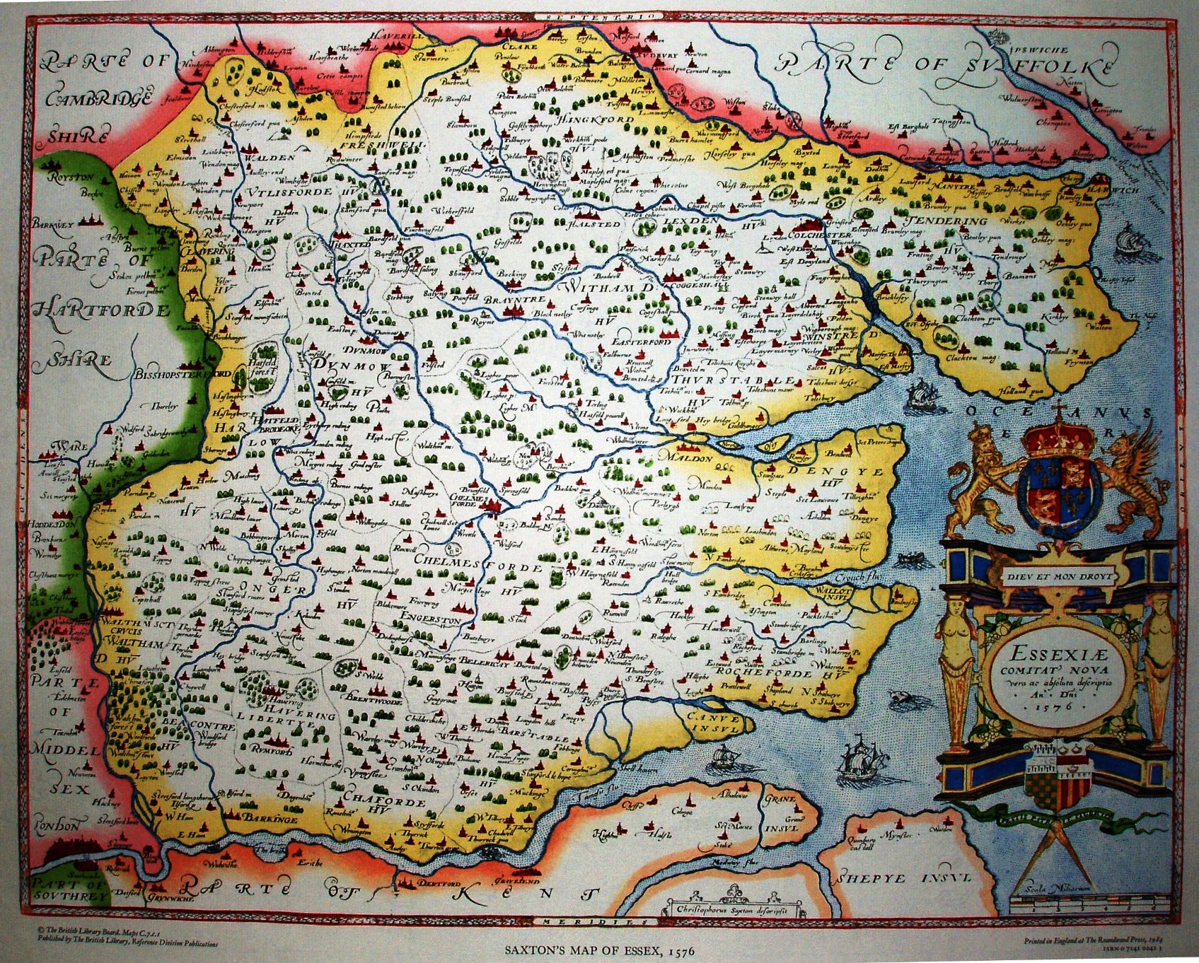
Scale of 6 Miliarium = 68.5mm, ie 2.22 "miles" to an inch, or 1:141,000. In practice it is closer to 1:192,000 (c3 miles to an inch), ie his "mile" is about 1.36 statute miles.
We have plenty of towns and villages, plus prominent rivers, but no roads, and only one bridge (in Chelmsford). It is a map of where things are, not how to get to them.
In practice there are plenty of little errors as to where things are - eg Audley End is shown south of Saffron Walden (instead of west of it), Newport is on the east bank (instead of the west bank) of the river Cam, Wethersfield is shown too far north and Finchingfield too far south. The whole map is rotated anti-clockwise as it is oriented to magnetic north - which in Saxton's time was around 12 degrees east (yes, east!) of true north. In fact it seems to be double-twisted anti-clockwise, as perhaps the engraver misunderstood the instruction and instead of twisting the fair copy clockwise he twisted it anti-clockwise!
The map plates passed through many publishers (eg see Lea 1693), and were still being used 200 years later (1772 by Dicey); see the MapMakers page for a history of their usage.