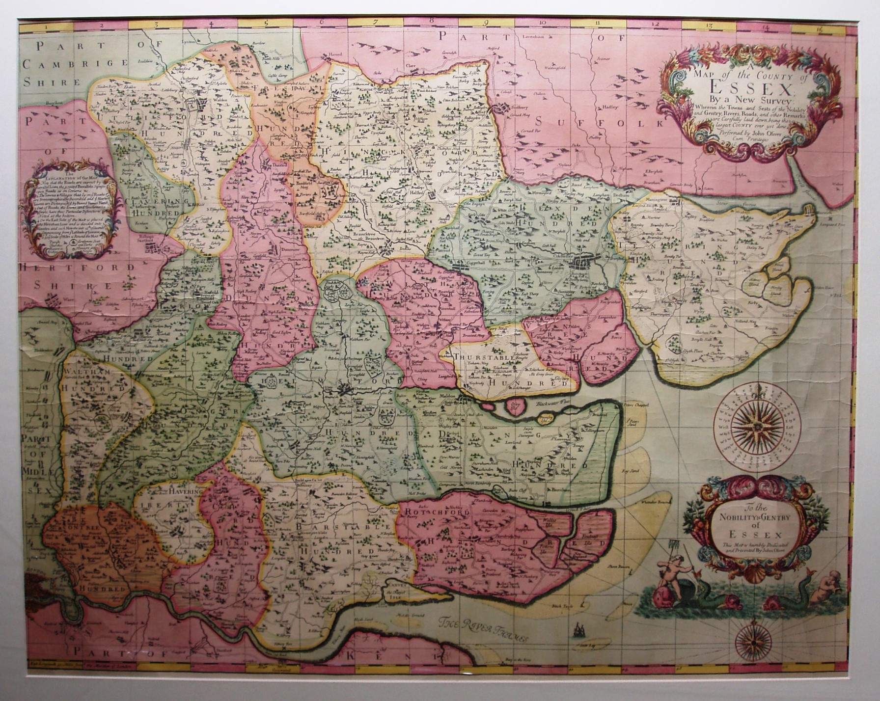
Essex
This is a picture of the ERO publication of the original, omitting the tables of gentry and their seats that are down each side of the original. ERO has the only known surviving original copy of this map.
The full list of actually surveyed maps have their own page.
Displayed scale of 10 miles = 164mm, or 1.6 miles/inch (1:100,000).
It seems very odd that this is the one and only example of this map in existence - no other copies have survived of what was (claimed to be) a fresh survey of the county. The topographical details look very like the Ogilby & Morgan 1678 map to me, very similar indeed.