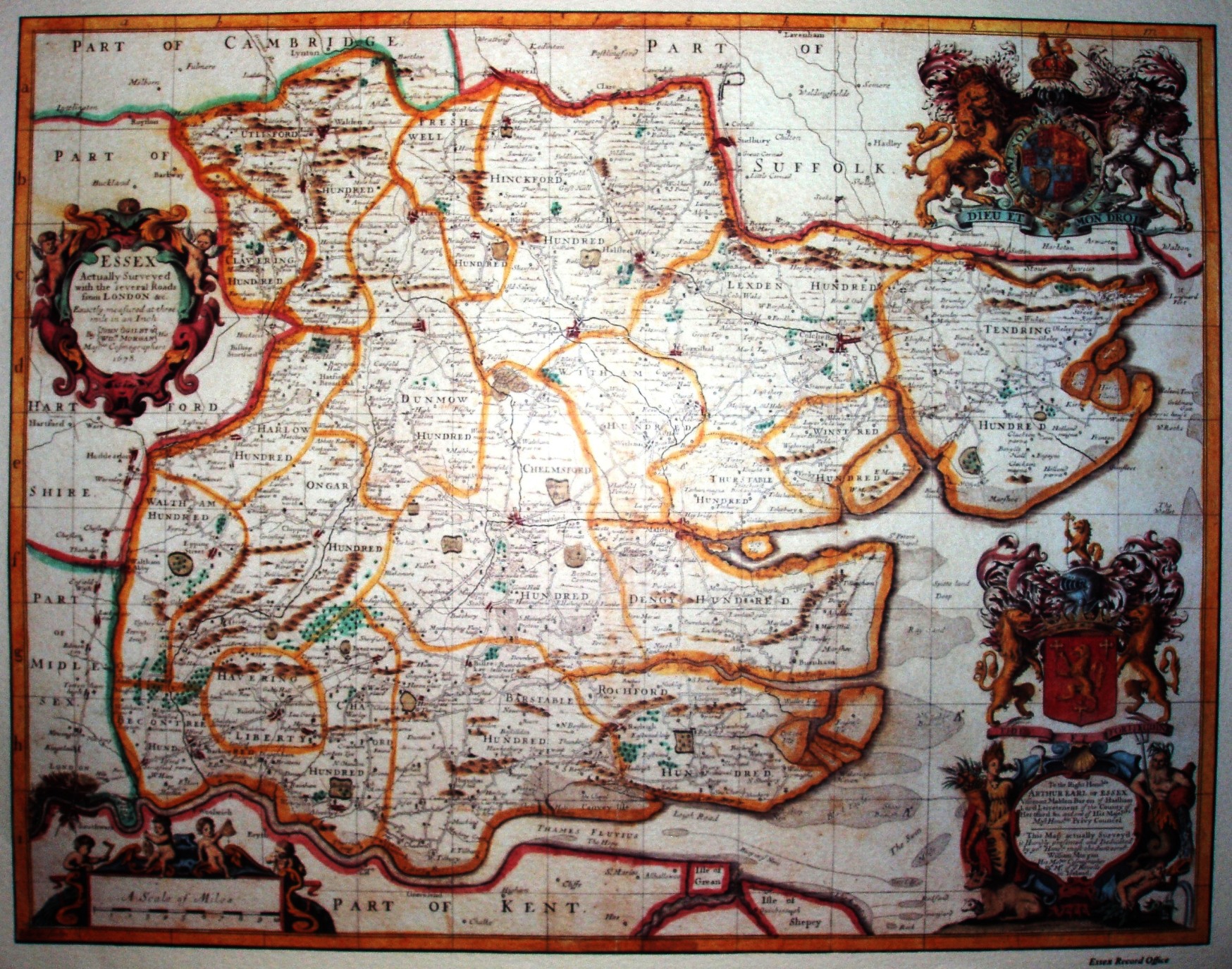
Essex
A map of major importance, as it was based on an actual survey, rather than on an existing map - the first one since Saxton in 1576, one hundred years earlier (if we ignore Norden's one of 1594, which didn't see the light of publication until 1840). Ogiliby is famous for his major road book - Britannia - that was published in 1675, but he also created maps of Kent and Middlesex after the 1666 Fire of London. This is the Essex Record Office reprint of their coloured copy of his Essex.
The full list of actually surveyed maps have their own page.
It was carried out by Ogilby's assistant Gregory King, together with Essex man Robert Felgate; it was engraved by Francis Lamb and published by William Morgan (Ogilby's step-grandson) three years after Ogilby's death. These are the first set of reliable roads shown within Essex - showing major roads, with significant side turnings marked. A later edition loses Ogilby's name.
Displayed scale of 10 miles = 82mm, or 3.1 miles/inch; scale actual = 3.2 miles/inch, or 1:200,000.