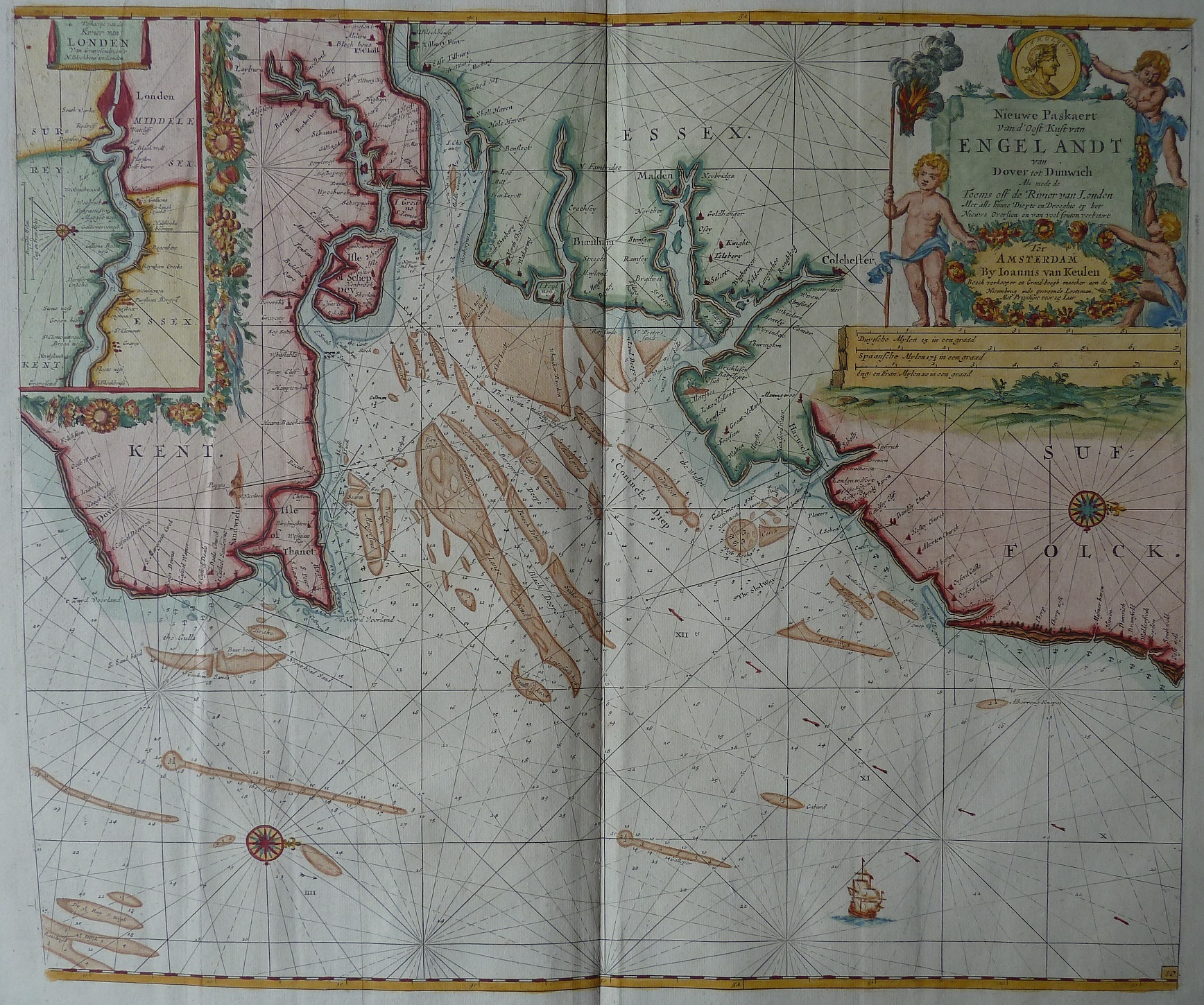
A Sea Chart of the East Coast of England from Dover to Dunwich
A 17th century Sea Chart containing an ornate title cartouche written in English, French, and Dutch commencing with "Nieuwe Paskaert van d'Oost Kustvan Englandt van Dover tot Dunwich". Three distance scales are present (Dutch, Spanish and English). There is also a River Thames inset box showing route to London. As usual with nautical charts compass North points to the right hand side of map.
Displayed scale of 5 miles = 21mm, or 6.0 miles/inch; scale actual = 8.1 miles/inch, or 1:500,000.
Johannes van Keulen (1654 - 1711) was a bookseller in Amsterdam and founded a publishing company in 1678. The family-owned company was successful until middle of 19th century; the sons and grandsons of Johannes also had large contribution. The two major atlases were the Zee Atlas first published 1680, and the Zee-Fakkel first printed 1681 with editions up to 1803.
My thanks to John Rudge who provided the image and text for this and the Greenville Collins 1695 maps.