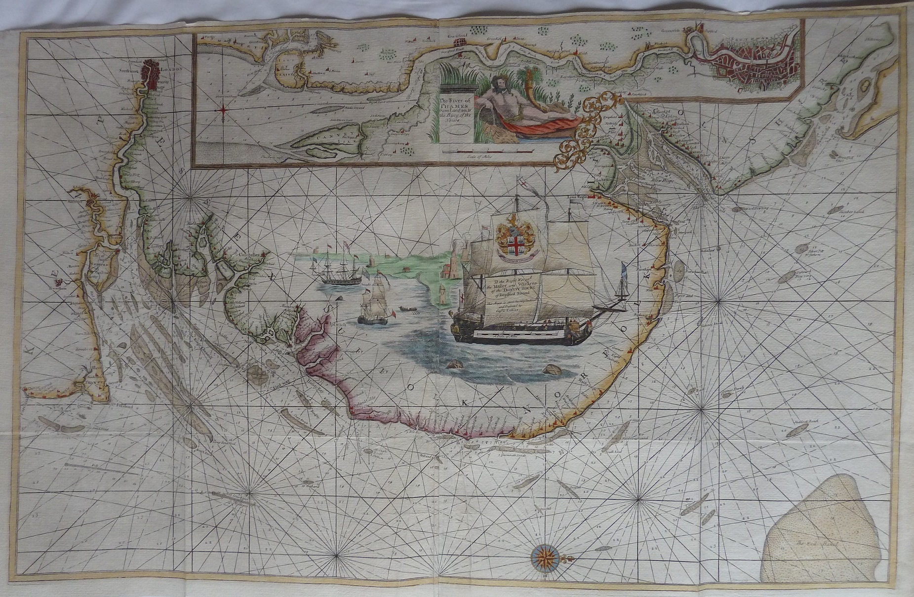
A Sea Chart of The River Thames and the East Coast of England from Kent to Norfolk
17th century Nautical Chart of The River Thames and the Coastal area from Kent to The Wash in Norfolk, published in The British Coasting Pilot by Captain Greenville Collins c. 1695. Featuring highly decorative cartouches and a detailed insert of the Thames and London. As common practice with nautical charts North points to the right hand side on the main map area but in this case within the Thames insert box North is pointing South, ie upside down to the viewer.
The displayed scale is 15 (English) miles to 83 mm, ie 4.6 miles/inch, or 1:290,000.
Capt. Greenville Collins (1645-1694) was commissioned in 1683 by Charles II, and appointed by Samuel Pepys (who was then Secretary to the Admiralty), to chart the coasts of Great Britain; he produced his Great Britain's Coasting Pilot in 1693, this was the first original sea atlas to be produced by an Englishman.
My thanks to John Rudge who provided the image and text for this and the van Keulen 1680 maps.